Flood risk plan to relocate thousands
Thousands of households living on the corridor of (Hong) Red River dyke system in Hanoi will likely be moved as part of the flood prevention plan, authorities and experts have said.
 Thousands of households living on the corridor of Red River dyke system in Hanoi will likely be moved as part of the flood prevention plan. (Source: VNA)
Hanoi (VNA) - Thousands of households living on the corridor of Red River dyke system in Hanoi will likely be moved as part of the flood prevention plan, authorities and experts have said.
The plan, recently approved by the Prime Minister, calls for renovating or relocating some 2,000 households along the river, which runs through Hanoi’s wards of Chuong Duong and Phuc Tan in Hoan Kiem district, Thanh Luong and Bach Dang in Hai Ba Trung district, and Ngoc Thuy, Bo De and Bat Trang in Long Bien district, as well as other neighbouring areas of Vong La-Hai Boi, Dong Ngac-Nhat Tao, Bac Cau and Dong Ngan.
Professor Ha Van Khoi from the University of Water Resources spoke to Tien Phong (Vanguard) newspaper, noting that the average water level continuously fell in the past decade, with the lowest recorded level of some 0.1m in 2010, creating favourable conditions for those households set a living along the river.
Meanwhile, a representative from the Bach Dang People’s Committee said these households were not included with the hundreds of illegal households built there since 1970.
The representative complained about the difficulties in relocating such households, as they were unprepared for the relocation and often seek to avoid cooperating with authorities.
Meanwhile, Dr Le Viet Son from the Institute of Water Resources Planning said the new Government’s flood prevention planning scheme presented a very progressive subject, particularly for the population residing outside the dyke system.
While providing prohibitions to those who violate the law on dyke protection or cause harm to dykes, the plan encourages households to reside and grow crops on islets or fertile lands along the river, according to the expert.
Earlier this year, Prime Minister Nguyen Tan Dung approved a planning scheme for flood prevention and dyke systems along the Red and Thai Binh rivers.
The two rivers flow through 15 cities and provinces – Hanoi, Hoa Binh, Ha Nam, Nam Dinh, Ninh Binh, Hung Yen, Hai Duong, Thai Binh, Hai Phong, Quang Ninh, Phu Tho, Vinh Phuc, Bac Ninh, Bac Giang and Thai Nguyen.
The plan aims to help the localities take the initiative in preventing floods and storms, contributing to their socio-economic stability as well as national security and defence.
It will also help relevant ministries, agencies and localities manage efforts to prevent damage caused by floods and storms, and outline investment plans for related projects until 2030, with a vision towards 2050.
Apart from forecasting the flood tide in these areas, the scheme proposes anti-flood solutions and methods to effectively use river shores, in line with the Dyke Law and relevant legal documents, in the service of national socio-economic development. It further defines prioritised items and estimates resources necessary for the realisation of solutions.
From 2016-2030, efforts will be focused on planting administrative border markers along dyke corridors, completing operational procedures of large reservoirs located on the upper parts of the rivers, upgrading dykes, afforestation plans, as well as infrastructure and equipment supporting the work.
Many parts of Hong and Thai Binh rivers in the north have seen its average water levels dramatically reduced – falling by 2m in 20 years. This has caused massive droughts among hundreds of thousands of hectares of farmland, blocked waterway transport and seriously polluted rivers.
Experts said that the flow of the Hong River needs to remain at some 1,200 cubic metres per second to supply enough water for the Red River delta.
However, in the past several years the flow fell to 900 cu.m per second. The river covers Hanoi and 25 other provinces in the north, with a population of 26 million people and an agricultural area of nearly 1.1 million hectares.-VNA


You should also see

Visitors flock to memorial commemorating Dien Bien Phu victory
Numerous groups from around the country have visited the Dien Bien Phu Historical Victory Museum, a repository of artefacts and documents about Vietnam’s resounding victory that echoed around the world.


See more
 Environment
Consultation workshop on Cambodia’s Funan-Techo canal held in Can Tho
The Vietnam National Mekong Committee (VNMC) on April 23 held a consultation workshop on Cambodia’s proposed Funan-Techo canal project which has raised concerns about potential impacts on the Mekong river.
 Environment
Up to 1,000 ban flowers planted at Dien Bien Phu battlefield relic sites
About 1,000 ban (Bauhinia variegate) flower trees were planted at relic sites such as A1 Hill, Him Lam resistance centre and De Castries Bunker at Dien Bien Phu battlefield relic complex in the northern province of Dien Bien on April 21.
 Environment
Vietnam acts to combat white pollution
The Vietnamese Government has issued a lot of policies, participated in various forums, and promoted international cooperation, demonstrating its activeness and affirming its determination to reduce plastic waste and join global efforts toward a planet without white pollution.
 Environment
Can Tho explores climate change cooperation with foreign countries
Leaders of the Mekong Delta city of Can Tho on April 17 met with a visiting delegation from the Embassies of Canada, New Zealand, Norway, and Switzerland to discuss issues related to erosion, climate change, migration, and the city's current needs for support and cooperation.
 Environment
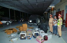
Nghe An: Man captured for illegal wildlife transport
Police in Vinh city, the central province of Nghe An, have captured a suspect involved in the illegal transport of 420 rare wildlife animals, including parrots, kangaroos, turtles, and monkeys.