ICAO corrects Sanya FIR map as requested by Vietnam
The International Civil Aviation Organisation (ICAO) has corrected the Sanya flight information region (FIR) map – which includes Vietnam’s Truong Sa (Spratly) archipelago as requested by Vietnam.
 China's illegal construction on Subi reef in Vietnam's Truong Sa (Source: SIA)
The map writes Chinese words “Sansha city – China” and draws a symbol of an airport on Chu Thap (Fiery Cross) Reef in Truong Sa, with the English words “Yong Shu airport – Sansha”.
On January 27, the ICAO President sent a letter to the CAAV that mentioned the issue.
Earlier on January 22, a representative from the Vietnamese embassy in Canada met the ICAO Assembly Chairman and Secretary General to hand over a diplomatic note dated January 15 affirming Vietnam’s sovereignty over Hoang Sa (Paracel) and Truong Sa archipelagoes.
The note also opposed the publication of the Sanya FIR map in general and the East Sea FIR map in particular, which have incorrect contents that impact Vietnam’s sovereignty over Hoang Sa and Truong Sa.
The embassy representative once again expressed concern over China’s recent test flights to Chu Thap (Fiery Cross) Reef, which is a violation of Vietnam’s sovereignty over Truong Sa, as well as ICAO’s flight safety regulations and standard within the Ho Chi Minh FIR managed by Vietnam.-VNA


You should also see
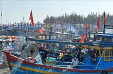
Government’s action programme cracks down on illegal fishing
A raft of measures to deal with illegal, unreported and unregulated (IUU) fishing is included in the Government’s freshly issued action programme as the country is striving to clamp down on illegal fishing, or else it will be hit by the European Commission (EC)’s warning card.


See more
 Society
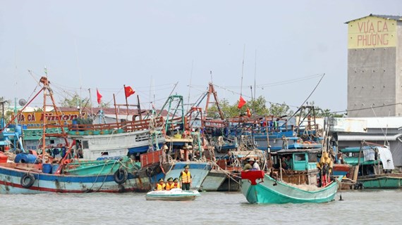
Ba Ria-Vung Tau strengthens measures to combat IUU fishing
The southern province of Ba Ria-Vung Tau has launched several specific tasks and measures to combat illegal, unreported, and unregulated (IUU) fishing.
 Society
Second banh mi festival slated for May
Ho Chi Minh City will host the second banh mi (Vietnamese sandwich) festival on May 17-19, aiming to promote the Vietnamese cuisine which has grown in popularity among foodies from around the globe.
InfographicQ1 2024: 51.3 million workers employed
51.3 million people in Vietnam aged 15 and above were employed during the first quarter of 2024, an increase of 174,100 compared to 2023, or 0.34 percent. The unemployment rate among the country’s working-age population has fallen by 2.24% compared to the same period last year.
 Society
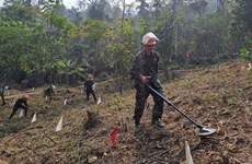
Training course opened for mine action workers
A pre-deployment training course for captains and technicians of the mine action for the Republic of Korea (RoK) - Vietnam Peace Village project was opened in Hanoi on April 22.
 Society
Exhibition spotlights significance of Dien Bien Phu Victory
Nearly 150 documents and artifacts highlighting the significance, stature, and value of the Dien Bien Phu Victory will be displayed at an exhibition slated for April 25 at the Vietnam National Museum of History.