Japan announces radiation map of Fukushima
The Tokyo Electric Power Company (TEPCO) for the first time has released
a map of radiation levels at Fukushima nuclear plant No.1, which
was devastated by the March 11 earthquake and tsunami.
The Tokyo Electric Power Company (TEPCO) for the first time has released
a map of radiation levels at Fukushima nuclear plant No.1, which
was devastated by the March 11 earthquake and tsunami.
According to TEPCO, they began making the map in late March with the aim of measuring radiation levels at 230 locations in the plant.
According to the map’s data, by April 23, the radiation levels measured at most of locations were under 100 millisieverts/hour.
However, the radiation level at more than other 30 spots around the reactors No.1 to No.4 still exceeded 100 millisieverts/hour.
Basing on the map, TEPCO could transfer their workers to the plant to repair and tidy up the ruins in safe conditions./.


You should also see
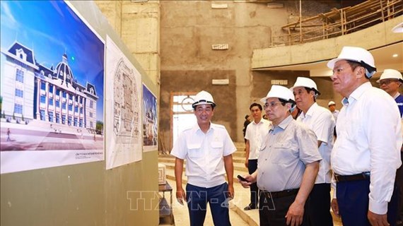
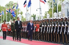
PM visits police command centre, checks cultural centre construction in Phu Tho
Prime Minister Pham Minh Chinh visited the command and control centre of the Phu Tho police and examined the construction of this northern province’s house of culture and arts on April 18.

See more
 World
World
Cambodia sees record number of tourists during traditional New Year holiday
Cambodia recorded almost 22 million domestic and international visitors travelling to different tourist destinations nationwide during the four-day traditional New Year holiday, from April 13 to 16.
 World
World
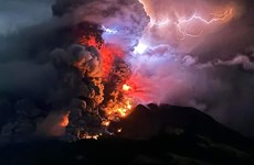
Indonesia raises alert level to highest, warns of tsunami as volcano erupts
An airport in Madano city, the capital of Indonesia’s North Sulawesi province, has been ordered closed while hundreds of people evacuated and the alert level raised to the highest on April 18 due to large-scale volcanic eruptions of Mount Ruang.
 World
World
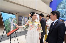
ASEAN culture promoted in Mexico
Typical and diversified culture of ASEAN countries is being promoted at the ongoing ASEAN Week at the headquarters of Mexico’s Chamber of Deputies in Mexico city from April 15-19.
 World
World
Thailand, New Zealand agree to elevate ties to strategic partnership
Thailand and New Zealand on April 17 agreed to upgrade bilateral ties to a strategic partnership by 2026, on the occasion of the 70th anniversary of bilateral diplomatic ties.
 World
World
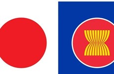
Japan’s 2024 Diplomatic Bluebook sketches out cooperation orientation with ASEAN
The Foreign Ministry of Japan on April 16 announced its 2024 Diplomatic Bluebook, which clarifies the country's orientations to expand relations with the Association of Southeast Asian Nations (ASEAN) in general and Vietnam in particular.