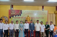
Maps displayed to prove Vietnam’s sea, island sovereignty
Nearly 100 maps along with many documents, objects and publications proving Vietnam ’s sovereignty over Truong Sa and Hoang Sa archipelagos are on display at an exhibition in Ninh Thuan province.
 Illustrative image (Source: VNA)
The display, jointly held by the Ministry of Information and Communications and the provincial People’s Committee, aims to promote national unity and the sense of responsibility among residents, especially youths, for protecting and claiming the country’s sovereignty over its sea and islands.
The exhibits, which are compiled and collected by domestic and international researchers and scholars, feature the process that Vietnam established and exercised its sovereignty over the two archipelagoes.
Among them are four sets of maps and other 30 maps published by China through different periods which show that Hoang Sa and Truong Sa archipelagoes don’t belong to the country.
Following the five-day event, the ministry will hand over the exhibits to Ninh Thuan province for preservation and public display.-VNA


You should also see

Vietnam, China promote judicial cooperation
Minister of Justice Le Thanh Long held talks with his visiting Chinese counterpart He Rong in Hanoi on April 19 to discuss measures to promote judicial cooperation between the two countries.


See more
 Society
Overseas Vietnamese in Russia commemorate Hung Kings
Overseas Vietnamese in Russia on April 18 held a ceremony in Moscow to mark the death anniversary of Hung Kings, the legendary nation founders.
 Society
Amended Land Law - breath of fresh air blown into real estate market: lawyer
The amended Land Law, approved by the National Assembly in January 2024, is expected to exert impacts on the business activities of overseas Vietnamese (OVs), including those in Australia., said a lawyer.
 Society
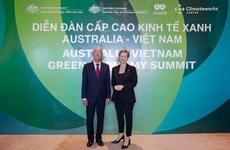
Green growth – a pillar of Vietnam-Australia comprehensive strategic partnership
The Australian Government, through agencies and partners, have launched many official development assistance (ODA) projects in Vietnam, including those on climate change adaptation and clean energy infrastructure.
 Society
Vietnamese in Thailand, Israel commemorate legendary nation founders
The overseas Vietnamese (OVs) communities in Thailand and Israel have held events to commemorate Hung Kings, the legendary founders of the nation.
 Society
Vietnamese youth pledge to join hands in climate change response
A representative of Vietnam has affirmed the youth’s commitment to joining hands in climate change response, while attending a plenary session of the UN Economic and Social Council (ECOSOC) Youth Forum in New York on April 17.