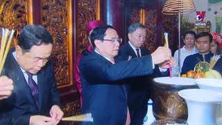
Exhibition features Vietnam’s sea sovereignty
A photo exhibition featuring Vietnam ’s boundary and the country’s
sovereignty over seas and islands opened in the central province of
Thua Thien Hue on November 25.
A photo exhibition featuring Vietnam ’s boundary and the country’s
sovereignty over seas and islands opened in the central province of
Thua Thien Hue on November 25.
On display are images contributing to defending Vietnam ’s sovereignty over the Hoang Sa (Paracel) archipelago and 21 stones taken from Vietnam ’s Truong Sa island.
Especially, there are historical documents to prove the legality of Vietnam ’s sovereignty over Truong Sa and Hoang Sa archipelagoes.
They include a 100 year-old map of the China’s Qing dynasty, which defined Hainan islands as China’s southernmost (not included Hoang Sa and Truong Sa archipelagoes of Vietnam); the Ministry of Public Works’ report on measurements in Hoang Sa under the 19 th year of Minh Mang reign (1838); a royal document relating to Quang Ngai’s envoy Dang Duc Thiem asking for tax reduction for ships serving mission in Hoang Sa under the 19 th year of Minh Mang reign; a royal ordinance relating to Hoang Sa flotilla, under the 15 th year of Minh Mang reign (1834), which is kept by the Dang family in An Hai commune, Ly Son district, Quang Ngai province and the images of nine tripod cauldrons under the Nguyen dynasty which engraved Hoang Sa and Truong Sa archipelagoes.
Song albums on the issue and the country’s achievements in national defence are also introduced at the exhibition, which will run until November 30.-VNA


You should also see
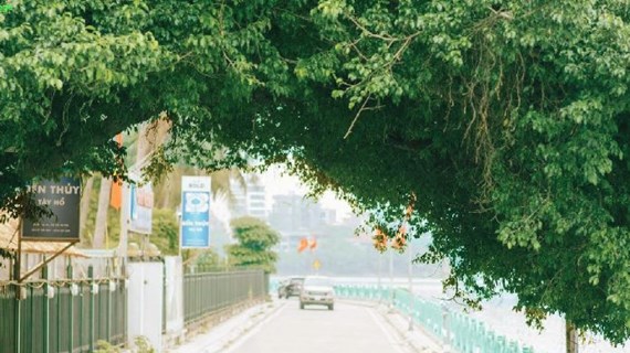
InfographicQuang An listed among the coolest streets in the world
Quang An Street in Tay Ho district, Hanoi, has been listed among the 30 coolest streets in the world by the British travel magazine Time Out.


See more
 Culture - Sports
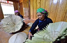
Preserving unique craft of making palm-leaf conical hats
Making palm-leaf conical hats is a traditional craft of the Tay ethnic people in Bac Ha district in northern mountainous Lao Cai province. Woven from wild palm leaves, the hats are dried and skilfully crafted into their distinctive conical shape. As well as protecting wearers from sun and rain, the hats are also part of the traditional outfit of local women.
 Culture - Sports
Vietnamese film wins highest award at Asian Film Festival in Italy
“Ben trong vo ken vang” (Inside the Yellow Cocoon Shell) by Vietnamese director Pham Thien An has won the best feature film award at the 21st Asian Film Festival held in Rome, Italy.
 Culture - Sports
AFC U23 Asian Cup: Vietnam crush Kuwait 3-1 in opener
The Vietnam U23 national football team started their journey at the 2024 AFC U23 Asian Cup with a 3-1 victory against Kuwait on April 17.
 Culture - Sports
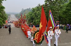
InfographicCommemoration of Hung Kings - Gathering the spirit of patriotism
The Commemoration of the Hung Kings and the Hung Kings Temple Festival are among the most important festivals of the year for Vietnamese people. The worship of the Hung Kings is not only part of the cultural identity of the Vietnamese community but has also transcended national boundaries to become an Intangible Cultural Heritage of Humanity.
 Culture - Sports
Vietnam draw with Myanmar at 2024 AFC Futsal Asian Cup’s group stage
Vietnam drew 1-1 with Myanmar in their first match of Group A at the 2024 AFC Futsal Asian Cup on April 17.