Exhibition gives insight into changes in Hanoi’s administrative boundary
An exhibition of archival materials on the changes in Hanoi’s administrative boundary since the feudal period to now was opened at the relic site of the Imperial Citadel of Thang Long on October 2.
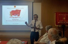
 At the opening ceremony (Photo: hanoimoi.com.vn)
Hanoi (VNA) – An exhibition of archival materials on the changes in Hanoi’s administrative boundary since the feudal period to now was opened at the relic site of the Imperial Citadel of Thang Long on October 2.
The event, which runs until October 15, is an activity to mark the 65th anniversary of the liberation of the capital from French colonialists (October 10, 1954-2019).
A total of 88 documents, maps and photos are on display, arranged in three periods, showing the administrative boundary of Hanoi before the August Revolution in 1945, during the time from 1945 to 1954, and after 1954.
As of 1945, Hanoi had a total area of 150 sq.km. The French colonial regime divided Hanoi into the urban and suburban areas. The urban area comprised of 8 sections, while the suburban area was divided into 8 “tong” (districts) with 36 communes.
During 1954-2010, Hanoi’s administrative boundary underwent four major adjustments in 1961, 1978, 1991 and 2008. Hanoi’s boundary was expanded in 1961 and 1978, but narrowed in 1991 before being broadened on a much larger scale in 2008.
The expansion of administrative boundary carried out under the 12th National Assembly’s Resolution 15/2008/QH12 in 2008 was a historic event with long-term and comprehensive impacts and influence on the capital city’s political, economic and social situation.
After merging with the whole neighbouring Ha Tay province, Me Linh district of Vinh Phuc province and four communes of Luong Son district, Hoa Binh province, the current Hanoi stretches over 3,328 sq.km, tripling the former acreage. The city has 577 communes, districts and townships of 29 districts and towns./.


You should also see
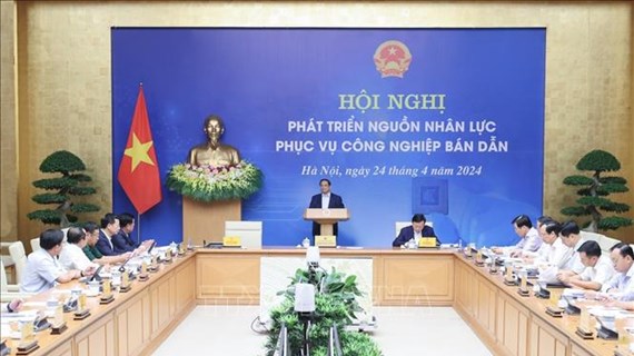
Semiconductor workforce development a breakthrough: PM
Human resources development in semiconductors should be considered a breakthrough in personnel training, Prime Minister Pham Minh Chinh said at a conference in Hanoi on April 24.


See more
 Society
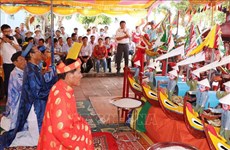
Victims in southwestern border defence war commemorated
A ceremony was held in the town of Ba Chuc, Tri Ton district, the Mekong Delta province of An Giang on April 24 to commemorate people massacred by the Pol Pot genocidal regime in 1978 during the southwestern border defence war.
 Society
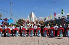
Quang Ngai: Traditional ceremony honours ancient Hoang Sa flotilla
An annual ceremony commemorating sailors of the historic Hoang Sa (Paracel) flotilla took place in the communal house of An Vinh village, Ly Son district, the central province of Quang Ngai, on April 24.
 Society
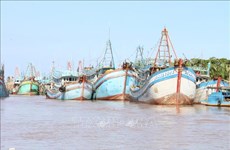
Ben Tre presses ahead with combating IUU fishing
The coastal Mekong Delta province of Ben Tre is pushing its efforts in preventing and combating illegal, unreported, and unregulated (IUU) fishing, preparing to work with the EC inspection team for the 5th time.
 Society
More officials investigated for suspected links with Phuc Son Group JSC
The police have officially started legal proceedings against Vice Chairman of the Vinh Phuc provincial People’s Committee Nguyen Van Khuoc and five others for their suspected involvement in the case at the Phuc Son Group JSC, Spokesman of the Ministry of Public Security (MPS) Lt. Gen. To An Xo said on April 23.
 Society
Dien Bien Phu Victory highlighted at symposium in Israel
The Vietnamese Embassy in Israel on April 23 hosted a symposium to commemorate the 70th anniversary of the Dien Bien Phu Victory (May 7, 1954-2024), with the participation of members of the Arab council of foreign relations, local scholars, and officials from Vietnamese representative offices in the country.