Exhibition on islands in East Sea opens in Dong Nai
An exhibition displaying maps and materials confirming “Hoang Sa (Paracel) and Truong Sa (Spratly) archipelagos belong to Vietnam – historic and legal evidence” kicked off in Dong Nai.
 Illustrative photo (Source:Internet)
The exhibition introduces nearly 100 maps, materials and images collected from various sources that have been published by researchers, and local and international scholars.
All materials, maps and images confirm Vietnam ’s sovereignty over the two archipelagos.
The main groups of materials in the exhibition are Chinese maps, Vietnamese nom-language maps and French versions issued by the Vietnamese feudal dynasties and French administrations in Indochina from the 17th to early 20th century, affirming the assertion, exercise and protection of Vietnam ’s sovereignty over the two archipelagos.
It also features copies of documents issued by the Socialist Republic of Vietnam from 1975 and some materials and publications complied and published by Western countries from the 18th to 19th century as well as some documented images on the exercise and protection of Vietnam ’s sovereignty over the two archipelagos from 1930.
The exhibition also displays sets of stamps, documented images and research works by Vietnamese and foreign scholars.
Noteworthy materials include four atlases published by the Qing Dynasty and the Republic of China government – one Atlas of the Chinese Empire (published in 1909), the Whole China Map (1917), and two books of Postal Atlas Maps in 1919 and in 1933.
These atlases are the products of the programme of building a Poastal map initiated by the Qing Dynasty in 1906 and was continued by the Republic of China government.
These maps show China’s southernmost point as Hainan island and do not mention Hoang Sa and Truong Sa islands at all.
The exhibition also displays the atlas Universel, in six volumes, compiled by Philippe Vandermaelen (1759-1869), a Belgian cartographer in 1827. Volume II includes the map “Partie de la Cochinchine” showing the Paracels as belonging to Vietnam .
The exhibition is one of the important public communication campaigns to raise awareness, unity, the sense of responsibility of people, including overseas Vietnamese, particularly the young generation, in protecting and affirming Vietnam ’s sovereignty over Truong Sa and Hoang Sa.
The exhibition takes place until July 23, after which all maps and materials will be handed over to Dong Nai province.-VNA


You should also see
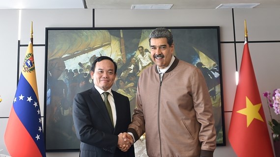
Vietnamese Deputy PM, Venezuelan President hold talks
Vietnamese Deputy Prime Minister Tran Luu Quang held talks with President of Venezuela Nicolás Maduro Moros in Caracas on April 18, as part of his ongoing official visit to the Latin American country.


See more
 Society
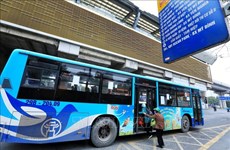
Hanoi’s virtual monthly passes help commuters travel with ease
Hanoi’s virtual monthly passes for public transport have been on offer for almost one month now, making travel more convenient for the city's commuters, reported the Hanoi Public Transport Management Centre.
 Society
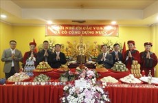
Overseas Vietnamese in Russia commemorate Hung Kings
Overseas Vietnamese in Russia on April 18 held a ceremony in Moscow to mark the death anniversary of Hung Kings, the legendary nation founders.
 Society
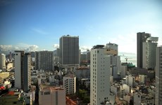
Amended Land Law - breath of fresh air blown into real estate market: lawyer
The amended Land Law, approved by the National Assembly in January 2024, is expected to exert impacts on the business activities of overseas Vietnamese (OVs), including those in Australia., said a lawyer.
 Society
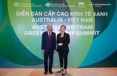
Green growth – a pillar of Vietnam-Australia comprehensive strategic partnership
The Australian Government, through agencies and partners, have launched many official development assistance (ODA) projects in Vietnam, including those on climate change adaptation and clean energy infrastructure.
 Society
Vietnamese in Thailand, Israel commemorate legendary nation founders
The overseas Vietnamese (OVs) communities in Thailand and Israel have held events to commemorate Hung Kings, the legendary founders of the nation.