Geographic infomation systems in southwest built
The Ho Chi Minh
City National University has worked with the southwest provinces of Dong
Thap, Soc Trang, Can Tho and Long An to implement "Mekong Delta
geographic information systems" (MGIS).
According to
Professor, Academician Nguyen Van Hieu, head of the project drafting
board, over recent years, a number of localities in the Mekong Delta
have started applying geographic information systems. However they are
discrete and do not connect with a unified system to better serve the
leadership and management of socio-economic development of the
localities as well as the whole region.
Therefore, the MGIS
is a good solution to help the Steering Committee for the Southwestern
Region, the People's Committees of 13 provinces and cities in the region
have fully updated information on the status of natural conditions,
natural resources, natural disasters and socio- economic situation and
development.
The Mekong Delta Geographic Information System
includes information technology infrastructure, interdisciplinary
science and technology staff, information processing and database as a
the intelligent maps. It is expected that the construction of geographic
information systems in the Mekong Delta will be completed in five
years.
Before implementing the MGIS project, the Ministry of
Natural Resources and Environment implemented a small-scale project on
surveying, measuring and establishing maps for building database of
management, conservation and sustainable development of wetlands of Dong
Thap Muoi.
Associated Professor. Dr Ha Minh Hoa,
Director of the Institute of Geodesy and Cartography, said that this
project is a basis to ensure the use of resources of the wetlands of
Dong Thap Muoi effectively and reasonably, help management agencies
propose strategies and develop policies consistent with the objectives
of conservation and sustainable development of wetlands, and ensure life
for the animals and plants.
In addition, the application of
information technology, especially GIS technology, will help save costs
and still provide high efficiency in the management and use of project’s
products, the director added.-VNA


You should also see

InfographicCommemoration of Hung Kings - Gathering the spirit of patriotism


See more
 Sci-Tech
Viettel opens data centre in Hanoi’s Hoa Lac hi-tech park
 Sci-Tech
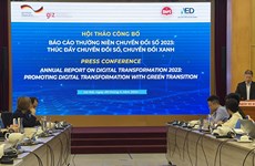
Report on digital transformation 2023 launched
 Sci-Tech
Building of legal corridor for AI development, application underway: Official
 Sci-Tech
Viettel, VNPT win Vietnam's first 5G spectrum auctions
 Sci-Tech