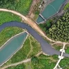
Scientists at the HCM City Institute of Resources Geography have succeeded in using 3D technology to predict areas under threat of land erosion along Thanh Da Canal, Binh Thanh district, HCM City.
The research is the first of its kind in Vietnam to adopt 3D modelling of geology to prevent land erosion and provide adequate surveying for construction in Vietnam , said PhD Le Minh Triet, Vietnam Academy of Science and Technology.
The study marks a real breakthrough, according to Le Ngoc Thanh, Deputy Head of the institute, especially as Thanh Da Canal is well-known as a part of the city particularly susceptible to land erosion.
Earlier this year, more than a hundred households along the river side were asked to move to a safer ground.
Thanh said it would save enterprises and local people huge sums that would have been spent building dykes along the river bank.
Since 2007, scientists from the institute have drilled two 40 metre-deep holes in Thanh Da in order to collect soil samples for GIS technology to construct a 3D model.
Analysing the site in three dimensions has given scientists an in-depth view of the composition of underground properties of clay, sand and water, helping define potential weakness.
Based on the research, the institute has marked six points at risk of land erosion, two of which are at extreme risk.
Positive results from the Thanh Da case will help scientists identify land erosion risks in other places and offer future potential for the use of 3D geology modelling for underground construction work.
The data collected should also provide data for construction sites that require particularly deep foundations.
The same model will be soon applied in the construction of Thu Thiem new urban area in District 2./.

