Hanoi hosts exhibition on Hoang Sa, Truong Sa
An exhibition displaying maps and documents on Vietnam’s Hoang Sa (Paracel) and Truong Sa (Spratly) archipelagos is underway at the Fisheries Resources Surveillance under the Directorate of Fisheries in Hanoi.
 Illustrative photo (Source: VNA)
Hanoi (VNA) - An exhibition displaying maps and documents on Vietnam’s Hoang Sa (Paracel) and Truong Sa (Spratly) archipelagos is underway at the Fisheries Resources Surveillance under the Directorate of Fisheries in Hanoi.
The event, from November 8-10, was co-organised by the Ministry of Information and Communications (MIC) and the Ministry of Agriculture and Rural Development.
At the opening, Deputy Minister of the MIC Hoang Vinh Bao said the event is part of important activities to raise awareness of the country’s sea and islands among officers and workers in the agricultural and fishery sectors.
It is also designed to nurture people’s love for the nation and enhance their solidarity and responsibility, especially youths, in protecting Vietnam’s sovereignty over the Hoang Sa and Truong Sa archipelagos.
On display are documents, items, publications and nearly 100 maps published by domestic and international researchers and scholars, including materials in Chinese, Nom (old Vietnamese writing using Chinese characters), modern Vietnamese and French issued from the 17th to the 20th century by the Vietnamese feudal states and the French government in Indochina (on behalf of the then Vietnamese state) proving Vietnam’s sovereignty over Hoang Sa and Truong Sa archipelagos as well as the country’s exercise of sovereignty over the islands.
The exhibition also features 65 maps certifying that the Hoang Sa and Truong Sa archipelagos belong to Vietnam, published by Western nations and Vietnam since the 17th century.
The exhibition also showcases publications and studies by domestic and foreign scholars, including the atlas Universel compiled by Belgian geographer Philippe Vandermaelen in 1827.-VNA


You should also see
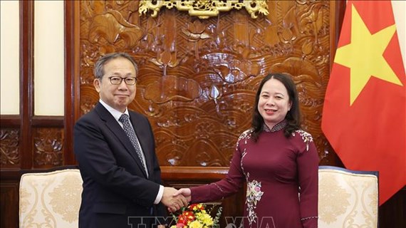
Japanese Ambassador bids farewell to Acting President
Acting State President Vo Thi Anh Xuan on April 24 hosted a reception for Japanese Ambassador to Vietnam Yamada Takio who came to bid farewell to her.


See more
 Society
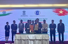
Vietnam, India boost education cooperation
The Indian Consulate General in Ho Chi Minh City held the India-Vietnam Meet in Education Sector, themed “InnovEdu: Training and Partnership” on April 24.
 Society
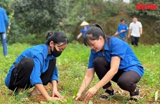
Victims in southwestern border defence war commemorated
A ceremony was held in the town of Ba Chuc, Tri Ton district, the Mekong Delta province of An Giang on April 24 to commemorate people massacred by the Pol Pot genocidal regime in 1978 during the southwestern border defence war.
 Society
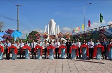
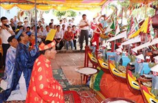
Quang Ngai: Traditional ceremony honours ancient Hoang Sa flotilla
An annual ceremony commemorating sailors of the historic Hoang Sa (Paracel) flotilla took place in the communal house of An Vinh village, Ly Son district, the central province of Quang Ngai, on April 24.
 Society
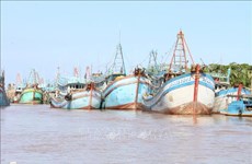
Ben Tre presses ahead with combating IUU fishing
The coastal Mekong Delta province of Ben Tre is pushing its efforts in preventing and combating illegal, unreported, and unregulated (IUU) fishing, preparing to work with the EC inspection team for the 5th time.
 Society
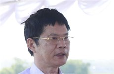
More officials investigated for suspected links with Phuc Son Group JSC
The police have officially started legal proceedings against Vice Chairman of the Vinh Phuc provincial People’s Committee Nguyen Van Khuoc and five others for their suspected involvement in the case at the Phuc Son Group JSC, Spokesman of the Ministry of Public Security (MPS) Lt. Gen. To An Xo said on April 23.