Highest tides in 23 years damage crops, aquaculture ponds
The highest tides in 23 years have damaged crops and aquaculture ponds on the southernmost Ca Mau peninsula.
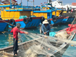
The highest tides in 23 years have damaged crops and aquaculture ponds on the southernmost Ca Mau peninsula.
Ca Mau province's Hydro-meteorological Forecasting Centre director Tran Tien Dung said high tides and heavy rain had swollen waters in coastal Nam Can district to 1.54 metres and 86 cm in Ca Mau city.
The province's Agriculture and Rural Development Department reports that sea water surged over dykes in the Dam Doi, Nam Can, Ngoc Hien, Phu Tan districts destroying more than 3,000 ha of shrimp and fish ponds.
About 5,000 ha of rice paddy and plantation was also flooded in the Thoi Binh, U Minh and Tran Van Thoi districts.
High tides from October to the middle of this month have damaged more than 15,800 ha and caused damage estimated at 4.1 billion VND (210,000 USD), reports provincial Irrigation Department director Nguyen Long Hoai.
Three days of high tides and heavy rain has also damaged 53,000 ha of farm land in neighbouring Bac Lieu province.
The province could lose 13,000 ha if the high tides continue, warns the provincial agriculture department.
The high tides, which are expected to continue until this weekend, submerged most of Nga Nam in Soc Trang province.
The 1.6-million-ha Ca Mau peninsular, on the southern tip of Vietnam , includes Can Tho city and Hau Giang, Soc Trang, Bac Lieu and Ca Mau provinces as well as part of Kien Giang./.


You should also see

PM expresses gratitude to contributors to Dien Bien Phu Victory
Prime Minister Pham Minh Chinh paid homage to General Vo Nguyen Giap and met with families of soldiers fighting in the Dien Bien Phu Campaign and policy beneficiaries in Muong Phang commune of Dien Bien Phu city, the northwestern province of Dien Bien, on April 16.


See more
 Society
Int’l media highlights Tim Cook’s visit to Vietnam
CEO of US-based tech giant Apple, Tim Cook, is paying a two-day visit to Vietnam, starting on April 15. The event has become a highlight of the international media.
 Society
Vietnam maintains momentum on advancing gender equality: UN Women Representative
The Vietnamese Government has maintained its momentum on advancing gender equality, said Caroline T. Nyamayemombe, UN Women Representative in Vietnam, in a recent interview granted to the Vietnam News Agency (VNA) on the occasion of the country’s election to the UN Women Executive Board for the 2025-2027 term.
 Society
Dien Bien gears up for Dien Bien Phu victory celebration
The northwestern province of Dien Bien is installing a system of mega outdoor LED screens, each measuring 40-60 square metres, to serve the celebration of 70 years of Dien Bien Phu victory.
 Society
Tien Giang maintains clean record in IUU fishing combat
The Mekong Delta province of Tien Giang has seen successes in combating illegal, unreported, and unregulated (IUU) fishing, with no violations by its fishing vessels reported since 2022.
 Society
Vietnam needs 20-30 billion USD investment for universal clean water access
Vietnam will need to invest 20-30 billion USD on water supply and drainage to make sure that 100% of the population has access to clean water, according to experts.