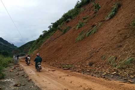
Landslide risks forecast in flooded localities
 A landslide-hit road is cleared for traffic in Lai Chau Province (Photo: VNA)
Flooded provinces are now facing high risks of landslides, according to the National Centre for Hydro-Meteorological Forecasting.
Their predictions are based on the rapid water flows reported in northern mountainous provinces, including Quang Ninh, Bac Giang, Thai Nguyen, Lai Chau, Dien Bien and Son La.
Quang Ninh has endured the heaviest prolonged rainfall in 40 years, leaving 17 people dead, 339 houses damaged and 8,952 others submerged under water.
Meanwhile, n early 1,700 people in north central Thanh Hoa province have been completely isolated from the outside world for several days after the Ma River broke its banks. A 20-billion-VND (917,400 USD) bridge crossing the Ma River was washed away by floods.
After days of torrential rain, water levels of the Thuong and Cau Rivers remain high while water is receding slowly in the Cau and Luc Nam Rivers and the lower course of the Thai Binh River. Thuong, Thao, Cau, Luc Nam, and Thai Binh are among the main rivers in northen Vietnam.
The centre predicted that by 7pm on August 5, water levels of the Cau River would reach 5.45 metres, compared to the current 5.29 metres. Water will continue to recede in the other rivers, it said.-VNA


