Map proving Vietnamese sovereignty on display
The early 20th century Chinese map that confirms Vietnam’s sovereignty over the Hoang Sa (Paracel) and Truong Sa (Spratly) Archipelagoes, is now on display at Vietnam National Museum of History.
The early 20th century Chinese map that confirms Vietnam’s
sovereignty over the Hoang Sa (Paracel) and Truong Sa (Spratly)
Archipelagoes, is now on display at Vietnam National Museum of History,
at 216 Tran Quang Khai Street in Hanoi from August 1 to November 30.
The decision to exhibit the map is to raise public awareness and the need for the country to safeguard the nation’s sovereignty over its territorial waters and islands.
The map was presented to the museum by Dr. Mai Ngoc Hong, a former head of the Han-Nom Institute’s Library and Documentation Department and Director of the Vietnam Family Annals Scientific Application and Research Centre, on July 25.
The old boundary map of Chinese provinces was used by the administration at the time and published during the Qing dynasty in 1904. It clearly indicates that the southernmost point of China is Hainan Island, not the Hoang Sa and Truong Sa Archipelagoes.
Academics and researchers, as well as the visitors to the museum from both Vietnam and overseas, can see with their own eyes the historical evidence and legal proof of Vietnam ’s sovereignty over Hoang Sa and Truong Sa.
Also on display at the museum are various artifacts including documents and maps concerning maritime trade and Vietnam’s sovereignty over its waters and islands.-VNA


You should also see

Investor confidence gains traction on improved business climate
Better investment climate, with simplified administrative producers and special incentives, has helped improve investor confidence, thus catalysing investments from a wider pool of both domestic and international investors for socio-economic development.


See more
 Society
Women's Union enhances connection with Vietnamese women abroad
A delegation from the Vietnam Women’s Union (VWU) led by its permanent Vice President Do Thi Thu Thao held a working session with the Permanent Mission of Vietnam to the United Nations headquarters in New York during a recent working trip to the US.
 Society
Vessels in Ha Long Carnival to perform, not to serve tourists: Authority
The Quang Ninh provincial Department of Transport has asked the administration of Ha Long city not to license the tourist vessels performing at the Ha Long Carnival 2024 to serve tourists during the programme due to safety concerns.
 Society
Millions of children in Vietnam protected by vaccination over 40 years: UN agencies
Millions of children in Vietnam have been protected by immunisation over the past 40 years, said the World Health Organisation (WHO) and UNICEF offices in Vietnam on April 25 when they mark the World Immunisation Week from April 24-30.
 Society
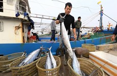
Government’s action program cracks down on illegal fishing
A raft of measures to deal with illegal, unreported and unregulated (IUU) fishing is included in the Government’s freshly issued action program as the country is striving to clamp down on illegal fishing.
 Society
Exhibition offers insight into Vietnam in the 1930s
An exhibition themed ‘Sofia Yablonska -The lifetime journey through the century’ opened in Hanoi recently as an event to celebrate the 32nd anniversary of the diplomatic relations between Vietnam and Ukraine.