Maps on Hanoi from 1873-1954 on display
An exhibition entitled, “Urban planning and administrative boundaries of
Hanoi in the period 1873-1954" opened at the National Archives Centre I
in Hanoi on Aug. 16 as part of celebrations of the millennium of the
capital city.
An exhibition entitled, “Urban planning and administrative boundaries of
Hanoi in the period 1873-1954" opened at the National Archives Centre I
in Hanoi on Aug. 16 as part of celebrations of the millennium of the
capital city.
The exhibition introduces 68 historic maps of Hanoi and nine important documents to help visitors learn about Hanoi through this period. There are some original cloth maps which are considered precious documents and have great historical value.
The documentation is divided into four sections, corresponding to the periods of planning and expanding the administrative boundaries of Hanoi .
The first section includes documents dating from 1873 to 1895 - the period marking the presence of the French in determining the boundaries and expansion plan in order to build Hanoi into a European-style city.
The second part includes documents dating from 1895 to 1927, a popular period for French architecture. Today, many streets in Hanoi still have French-style architecture.
The remaining parts of the exhibition are divided into two periods dating from 1928 to 1945 and from 1946 to 1954.
The exhibition will last until Dec. 31 at the National Archives Centre I at No. 18, Trung Yen 1 Street, Cau Giay District in Hanoi./.


You should also see
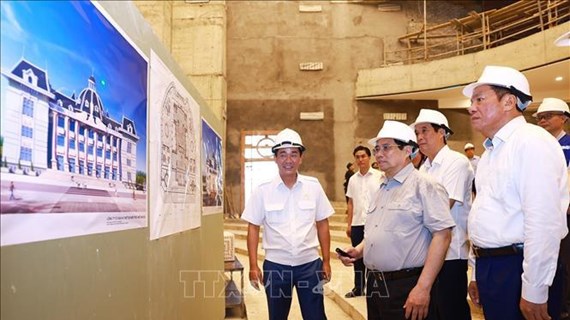
PM visits police command centre, checks cultural centre construction in Phu Tho
Prime Minister Pham Minh Chinh visited the command and control centre of the Phu Tho police and examined the construction of this northern province’s house of culture and arts on April 18.


See more
 Culture - Sports
Hanoi exhibition marks Hung King’s Commemoration Day
The Hanoi Museum on April 18 organised a thematic exhibition themed "Echoes" to introduce to the public nearly 100 precious artifacts, images, and documents of Vietnam from the Hung Kings’ reign with Dong Son Culture about 2,000 years ago.
 Culture - Sports
Preserving unique craft of making palm-leaf conical hats
Making palm-leaf conical hats is a traditional craft of the Tay ethnic people in Bac Ha district in northern mountainous Lao Cai province. Woven from wild palm leaves, the hats are dried and skilfully crafted into their distinctive conical shape. As well as protecting wearers from sun and rain, the hats are also part of the traditional outfit of local women.
 Culture - Sports
Vietnamese film wins highest award at Asian Film Festival in Italy
“Ben trong vo ken vang” (Inside the Yellow Cocoon Shell) by Vietnamese director Pham Thien An has won the best feature film award at the 21st Asian Film Festival held in Rome, Italy.
 Culture - Sports
AFC U23 Asian Cup: Vietnam crush Kuwait 3-1 in opener
The Vietnam U23 national football team started their journey at the 2024 AFC U23 Asian Cup with a 3-1 victory against Kuwait on April 17.
 Culture - Sports
Vietnam draw with Myanmar at 2024 AFC Futsal Asian Cup’s group stage
Vietnam drew 1-1 with Myanmar in their first match of Group A at the 2024 AFC Futsal Asian Cup on April 17.