Nearly 19,000 fire hotspots identified in SEA, Papua New Guinea
Indonesia’s Meteorology, Climatology, and Geophysics Agency (BMKG) detected at least 18,895 hotspots of forest and land fires in Southeast Asia and Papua New Guinea over the past two weeks.
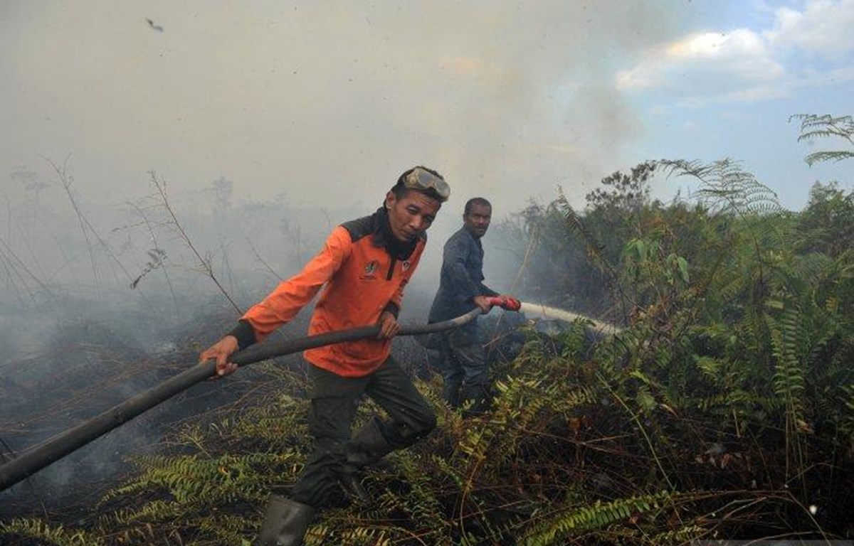
 Some firefighters in Jambi City attempt to extinguish peat fires in Kumpeh Ulu, Muarojambi, Jambi, on August 6.(Photo: ANTARA/Wahdi Septiawan/foc)
Jakarta (VNA) – Indonesia’s Meteorology, Climatology, and Geophysics Agency (BMKG) detected at least 18,895 hotspots of forest and land fires in Southeast Asia and Papua New Guinea over the past two weeks.
The figure was obtained from the Terra Aqua Satellite (LAPAN) and Himawari Satellite (Japan JMA) imagery and analysed by the BMKG.
Accordingly, on August 4, the number of hotspots in Indonesia went up to 3,191, concentrated in the provinces of Riau, Central Kalimantan, and West Kalimantan. They were also detected in other ASEAN countries, including Malaysia, Thailand, Cambodia, Vietnam, Myanmar, and the Philippines.
Deputy head of the BMKG’s meteorology section Mulyono R. Prabowo, said the increasing number was a result of current atmospheric conditions and relatively hot and dry weather.
The BMKG has continued to coordinate with the Indonesian Ministry of Environment and Forestry, National Disaster Mitigation Agency (BNPB), and some local disaster mitigation agencies, other related agencies, and the community to step up preparations for the risks of land and forest fires, air and smoke pollution, and drought that can cause clean water shortages.
On August 7, the BNPB identified some 773 hotspots scattered across several areas in Indonesia. Of the total, 549 were classified in the medium category (30 to 70 percent) and 224 in the high category (equal or above 80 percent).
Based on the SiPongi Forest and Land Fire Monitoring System of the Indonesian Ministry of Environment and Forestry, fires have ravaged close to 136,000 hectares of forest and land in 2019.-VNA


You should also see

Semiconductor workforce development a breakthrough: PM
Human resources development in semiconductors should be considered a breakthrough in personnel training, Prime Minister Pham Minh Chinh said at a conference in Hanoi on April 24.


See more
 ASEAN
ASEAN
UK supports ASEAN’s economic integration
The UK delegation to ASEAN held a seminar in Jakarta, Indonesia on April 24 to discuss the ASEAN-UK economic integration programme.
 World
World
Cambodia, Laos vow to boost bilateral ties
Cambodia and Laos vowed to boost their bilateral relations and cooperation for mutual benefits during Lao President Thongloun Sisoulith’s State visit to the neighbouring country on April 23-24.
 World
World
Bank Indonesia raises interest rates to highest level in 7 years
Bank Indonesia (BI) on April 24 raised interest rates to their highest level in seven years.
 World
World
Rail connects Vientiane, China's Guizhou province
The Guiyang-Laos tourist train will be launched on 8 May, signifying a pivotal step in boosting tourism and cultural ties between China and Southeast Asia.
 ASEAN
ASEAN
ASEAN Future Forum 2024 looks to ensure comprehensive security for community
The ASEAN Future Forum 2024 (AFF 2024) entered its second plenary session in Hanoi on the afternoon of April 23, discussing ways to ensure comprehensive security for the people-centred ASEAN Community.