Priceless document affirms Vietnam’s sovereignty over sea, islands
The Ministry of Information and Communications has held a ceremony to
receive and unveil the 1827 World Atlas Bruxelles which has been judged
by the French and Belgian historians as the high scientific and legal
value in affirming the undeniable sovereignty of Vietnam over the Hoang
Sa (Paracel) and Truong Sa (Spratly) archipelagoes.
According to the Authority of Foreign Information Service under the ministry, in 1827, Philippe Vandermaelen (1795-1869), a remarkable geographer and member of the Paris Geography Association, published the World Atlas that comprises 6 volumes with 7 general maps of 5 continents, 381 detailed maps, 40 pages of statistics and a lot of information on natural, political and mineral geography.
The Atlas was completed on the basis of the best maps in the world at that time, together with the information from the astronomical observations or from the voyages to many lands on the earth and were drawn in an uniform way according to the scale of 1/1641836, and size of 53,5 x 37cm, which can be pieced together to make a globe with diameter of 7.755 m.
There are 111 maps on Asia, arranged mainly in volume 2 of the Atlas. Vietnam was introduced in the maps number 97, 105, 106 and 110. The Partie de la Cochichine map is the 106th map with the coastline from the Central part from the 12th Parallel to the 16th Parallel.
In offshore, Paracels (Hoang Sa) was drawn in detail and preciseness from the 16th to the 17th Latitude and from 109th to 111th Longitude. The Paracel archipelago in the map of islands of Pattles and Duncan in the west; Tree and Lincoln and Rocher au desus de l’eau (the shoal reef) in the east and Triton in the southwest, right below the 16th latitude; the Investigateur was deep down the south at about 14.5th Latitude. Beside the Paracels, the map also introduces in short about the Empire of An Nam.
Close to the Parties de la Chochichine is the map 98 with the name the Parties de la Chine up above at the 18th Latitude to 21st Latitude and the 106th Longitude to the 114th Longitude, where Guangdong and Hainan were drawn. This shows that the southernmost boundary of China was not close to the 18th Latitude.
All the maps of China from the decades of early 20th Century backwards were completely similar to the maps of the West, with China’s southernmost territories not going beyond the 18th Latitude. This not only reflects the objectivity and preciseness of the Atlas, but also makes a contribution to increasing the value proving Vietnam’s sovereignty over the Paracels which was manifested in the Partie de la Chochichine map.
In early 16th Century, there were a number of Western maps drawn about the East Indian region with the mark of the place name of Paracels in the middle of the East Sea and the coast line west of the Paracels (the Central coast of Vietnam) was marked with the Coast de Paracels (the Hoang Sa sea area).
Entering the 17th Century and particularly the 18th Century, a lot of maps reflected more clearly the geographical position and characteristics and the relations of sovereignty of the Paracels with the Dang Trong region. However, most of these maps still placed the Paracels in the common region of East India.
Only until the early 19th Century when the Nguyen Dynasty was established with affirmation of Vietnam’s sovereignty in a full way, really following the principle of acquisition of territory recognized and praised by the West, and the West maps had officially recognized the Paracel archipelago lay within Vietnam’s territories and belonged to Vietnam.
The Partie de la Cochichine is the first map which drew in the absolutely precise way the position (longitude and latitude), geographical characteristics, the names of the biggest islands by the West and most importantly it is the Hoang Sa archipelago. The map was placed inside the Cochichine area, an inseparably organic part of the Empire of An Nam, proving in a clear and precise manner Vietnam’s sovereignty over the Paracels recognized internationally.
The World Atlas of Phillipe Vandermaelen in general and the Partie de la Cochichine in particular with all aspects considered can be regarded as the priceless document which not only helps raise the standard scientific value of the propaganda and education of sovereignty over sea and islands, but also the convincing, true, effective and internationally valuable evidence for the struggle to defend Vietnam’s sacred sovereignty over sea and islands.-VNA


You should also see

Youths' efforts yield socio-economic fruits
Many activities were carried out across the nation during the Vietnam’s Youth Month, an annual festivity taking place in March to celebrate the establishment of the Ho Chi Minh Communist Youth Union (HCYU), contributing to the nation’s socio-economic development, heard a conference held by the union's Central Committee in Hanoi on April 23.


See more
 Society
Exhibition offers insight into Vietnam in the 1930s
An exhibition themed ‘Sofia Yablonska -The lifetime journey through the century’ opened in Hanoi recently as an event to celebrate the 32nd anniversary of the diplomatic relations between Vietnam and Ukraine.
 Society
Vietnam, India boost education cooperation
The Indian Consulate General in Ho Chi Minh City held the India-Vietnam Meet in Education Sector, themed “InnovEdu: Training and Partnership” on April 24.
 Society
Victims in southwestern border defence war commemorated
A ceremony was held in the town of Ba Chuc, Tri Ton district, the Mekong Delta province of An Giang on April 24 to commemorate people massacred by the Pol Pot genocidal regime in 1978 during the southwestern border defence war.
 Society
Quang Ngai: Traditional ceremony honours ancient Hoang Sa flotilla
An annual ceremony commemorating sailors of the historic Hoang Sa (Paracel) flotilla took place in the communal house of An Vinh village, Ly Son district, the central province of Quang Ngai, on April 24.
 Society
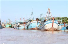
Ben Tre presses ahead with combating IUU fishing
The coastal Mekong Delta province of Ben Tre is pushing its efforts in preventing and combating illegal, unreported, and unregulated (IUU) fishing, preparing to work with the EC inspection team for the 5th time.