Kien Giang (VNA) – A road map for turning Phu Quoc island offshore southern Kien Giang Province into a smart city was unveiled on the island on September 29.
Smart city Phu Quoc will be based on the Vietnam Posts and Telecommunications Group’s Smart City model and will be implemented in four stages.
Stage one in 2016 will focus on network infrastructure, information technology and basic services like building e-government, making Wifi available on the whole island, installing CCTV cameras and building the environment observation stations.
The second stage from 2017 to 2018 will build a data centre, a concentrated operation centre and continue implementing basic and smart services.
The third stage from 2019-2020 will continue implementing smart and added value services while the fourth and final stage will make Phu Quoc an increasingly smart city.
Kien Giang authorities recommended that the plan should focus on tourism, traffic, e-government and environment.
Vice Chairman of the Kien Giang Provincial People’s Committee Mai Van Huynh said relevant agencies need to spread the project to locals and tourists and channel resources to implement the project effectively.
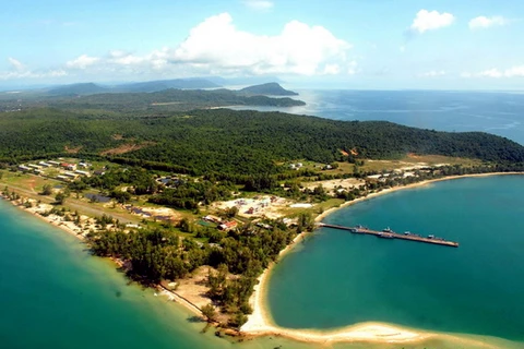
Phu Quoc is Vietnam’s largest island and is a district of the Mekong Delta province of Kien Giang. It has an area of nearly 600 sq.km and a population of over 100,000.-VNA


