Spectacular mountains and rivers - Scenic spots in Quang Ngai province
 Overview of My Khe beach where the Tra Khuc river flows into the sea (Photo: VNA)
Quang Ngai (VNA) - Thien An mountain and Tra Khuc river, the top scenic spots in the central province of Quang Ngai, are familiar to not only local people but domestic and foreign visitors as well. These iconic spots have become an epicenter for economic and tourism development in the province.
Tra Khuc, the largest river in Quang Ngai, originates from 2,350m high Dac To Ron mountain before merging with the Rhe, Xa Lo (or Dak Xa Lo), Rinh (or Dak Drinh) and Tang rivers. The river runs to the east through Son Ha, Son Tinh and Tu Nghia districts and Quang Ngai city, then enters the sea through Dai Co Luy estuary. The river offers spectacular views while running through Quang Ngai where Thien An mountain looms silently by the river.
Along the Tra Khuc river is beautiful natural scenery, including four of Quang Ngai’s 12 natural wonders. They are Thien An Niem Ha (Thien An mountain - heavenly seal stamped on the river), Long Dau Hy Thuy (Long Dau mountain - dragon head playing with water), Ha Nhai Van Do (Ha Nhai wharf in sunset), and Co Luy village. Viewed from Thien An mountain, there are also many other picturesque places such as Thien But Phe Van (Thien But mountain-heavenly pen writing on cloud), Thach Bich Ta Duong (Thach Bich mountain in sunset glow), Thach Ky Dieu Tau (old man fishing on a cliff) reef, and An Hai sandbar.
The Tra Khuc river has formed waterway trade and created a sub-region of Tra Khuc river culture, which covers a large area with widespread influence across Quang Ngai. This enriches the province’s unique culture with a huge treasure of folk songs and verses featuring the life of local farmers and traders.
Along the Tra Khuc river are popular craft villages, which include a blacksmithing village in Tinh Minh commune, Son Tinh district; a beansprouts village in Van hamlet, Son Tinh; Sung Tich and Thanh Kiet vegetable villages in Son Tinh and Tu Nghia districts; a flower village in Nghia Ha commune, Nghia Hoa district and North and South Co Luy welcome mat villages in Son Tinh and Tu Nghia. The area is also known nationwide for making rock sugar, cube sugar and coarse cane sugar.
On the banks of the Tra Khuc river are wharfs where boats can stop overnight and their owners can make barter for goods. Next to the river wharfs are stages for hat ho responsive singing and bai choi folk singing, usually organized during full moon nights, the lunar new year festival (Tet) and other festive events.
Viewed from the Co Luy village citadel is the immense area of Ly Son - Sa Huynh geopark and further away is green Ly Son island, the native land of the Hoang Sa (Paracel) flotilla. Ly Son island, regarded as Vietnam’s Maldives, is expected to promote tourism in Quang Ngai.
The river, which brings alluvium from the peak of Dac To Ron mountain, runs 135 km through mountain and midland areas before entering the sea at Co Luy in Tu Nghia district. At the end of the river, an industrial triangle has been formed in Son Tinh and Binh Son districts and Quang Ngai city and is one of the leading industrial hubs in central Vietnam./.


You should also see

China’s fishing ban in East Sea violates Vietnam’s sovereignty: spokesperson


See more
 Society
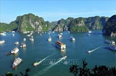
Vessels in Ha Long Carnival to perform, not to serve tourists: Authority
 Travel
Ninh Binh to organise various activities on upcoming holidays to lure more tourists
 Destinations
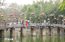
Visitors flock to memorial commemorating Dien Bien Phu victory
InfographicDa Lat most searched-for destination during upcoming holidays
 Travel