Typhoon Son Tinh weakens to low pressure
“Son Tinh,” the third storm appeared in the East Sea so far this year, weakened to a low pressure after making its landfall in the central provinces of Thanh Hoa and Nghe An on July 18, according to the National Centre for Hydro-Meteorological Forecasting.
 The roofs of 13 houses in Xuan Pho commune, Nghi Xuan district Ha Tinh province were blown away (Photo: VNA)
Hanoi (VNA) – “Son Tinh,” the third storm appeared in the East Sea so far this year, weakened to a low pressure after making its landfall in the central provinces of Thanh Hoa and Nghe An on July 18, according to the National Centre for Hydro-Meteorological Forecasting.
At 4:00am of July 19, the centre of the low pressure was at the 19.0 degrees north and 105.2 degrees east, in the mainland of Nghe An and Thanh Hoa, with highest wind speeds of 40-60 kilometres per hour.
In the next 12 hours, the low pressure is forecast to move westwards with a speed of 20-25 kilometres per hour, and continue to become weaker.
Affected by the low pressure, in early July 19, the sea will be rough in the Tonkin Gulf with strong wind at 6-7 levels and 2-4m high waves.
Strong wind also swept through the mainland in Thai Binh, Nam Dinh, Ninh Binh, Thanh Hoa, Nghe An and Ha Tinh provinces, where disaster risk alert mounted to level three.
The northern and north central regions will see more strong rains from July 19-21.
Due to torrential rains from July 18, the roofs of 13 houses in Xuan Pho commune, Nghi Xuan district Ha Tinh province were blown away.-VNA


You should also see

Vietnam urged to build legal corridor for AI industry
Vietnam needs a policy on artificial intelligence (AI) to help this industry develop strongly, while minimising risks, according to insiders.


See more
 Environment
Vietnam supports global agreement on plastic pollution
A delegation of Vietnamese negotiators joined those from 176 countries worldwide at the fourth session of the Intergovernmental Negotiating Committee (INC-4) on plastic waste in Ottawa, Canada, on April 23.
 Environment
Consultation workshop on Cambodia’s Funan-Techo canal held in Can Tho
The Vietnam National Mekong Committee (VNMC) on April 23 held a consultation workshop on Cambodia’s proposed Funan-Techo canal project which has raised concerns about potential impacts on the Mekong river.
 Environment
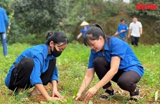
Up to 1,000 ban flowers planted at Dien Bien Phu battlefield relic sites
About 1,000 ban (Bauhinia variegate) flower trees were planted at relic sites such as A1 Hill, Him Lam resistance centre and De Castries Bunker at Dien Bien Phu battlefield relic complex in the northern province of Dien Bien on April 21.
 Environment
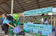
Vietnam acts to combat white pollution
The Vietnamese Government has issued a lot of policies, participated in various forums, and promoted international cooperation, demonstrating its activeness and affirming its determination to reduce plastic waste and join global efforts toward a planet without white pollution.
 Environment
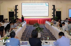
Can Tho explores climate change cooperation with foreign countries
Leaders of the Mekong Delta city of Can Tho on April 17 met with a visiting delegation from the Embassies of Canada, New Zealand, Norway, and Switzerland to discuss issues related to erosion, climate change, migration, and the city's current needs for support and cooperation.