Vietnam completes coastal wetland mapping
The National Remote Sensing Centre under the Ministry of Natural
Resource and Environment has completed a set of maps of coastal wetland
zones on a scale of 1/1,000,000.
The National Remote Sensing Centre under the Ministry of Natural
Resource and Environment has completed a set of maps of coastal wetland
zones on a scale of 1/1,000,000.
According to the centre, this is the first time Vietnam has made a set of maps that provides full information of various types of coastal wetland in the country’s 29 coastal provinces and cities.
In addition, the maps also provide acreages and data of each type of wetland at district and provincial-level administrative units as well as on the national scale.
The maps will serve as the basis for designing plans to preserve the wetland zones and prevent them from natural disasters as well as to make sustainable use of their ecosystems./.


You should also see

VNA marks 70th anniversary of Dien Bien Phu Victory with various activities
The Vietnam News Agency (VNA) hosted an array of activities to celebrate the 70th anniversary of the Dien Bien Phu Victory (May 7, 1954 - 2024).


See more
 Environment
Communication campaign calls for wildlife conservation efforts
The central province of Quang Binh, home to the UNESCO-recognised Natural Heritage site of Phong Nha Ke Bang National Park, on April 13 launched a communication campaign in response to the World Wildlife Day (March 3) and the National Biodiversity Restoration Year 2024.
 Environment
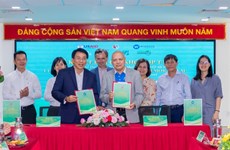
Saigon Co.op ties up with Winrock International for waste circulation
Saigon Co.op signed an MoU with non-profit Winrock International in HCM City on April 12 to reduce environmental pollution by developing a waste circulation model, enhancing waste separation at source and raising the extended producer responsibility.
 Environment
Solutions proposed to tackle growing challenge of electronic waste
Vietnam faces a growing problem with electronic waste (e-waste), according to a study by the Hanoi University of Science and Technology's Centre of Science-Technology and Environment.
 Environment
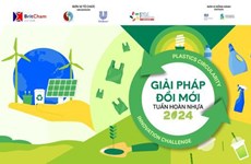
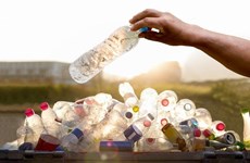
Contest seeks innovative solutions to recycle plastic
The innovative solution contest 2024 was launched in Hanoi on April 12, aiming to seek solutions in the plastic circular value chain, especially new and creative solutions in improving the capacity to collect, process and recycle plastic packaging.
 Environment
Co To calls for actions to prevent plastic pollution in tourism activities
Co To island district in the northeastern province of Quang Ninh has asked local accommodation facilities and travel firms to apply environmental protection measures in tourism business activities to build an island free of plastic bags and other single-use items.