Vietnam presents precious map to House of European History
The special map, which is 84 cm long and 45 cm wide, was drawn by Jean Louis Taberd from France and published in India’s Serampore city in 1838. It depicts the archipelago of “Paracel seu Cat Vang” - the Hoang Sa archipelago within Vietnamese waters.
It was the largest and most complete map of Vietnam at the time. Its name is written in three languages - Han (Chinese characters), Vietnamese script, and Latin script. All landmarks on the map, including those in China, Laos, and Cambodia, are written in Vietnamese script, while the footnotes are in Vietnamese, Latin and French characters.
The “Paracel seu Cat Vang” written on the map affirms that the archipelago is Cat Vang, or Hoang Sa in Vietnamese.
During his stay in Belgium and Europe, Son also received 13 sets of documents on Vietnamese borders and territory from international law professor Jean Salmon, including a valuable document set on Vietnam’s Hoang Sa archipelago written in 1960./.


You should also see

PM requires full legal corridor to promote national digital transformation


See more
 Videos
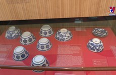
Belgian museum houses thousands of Vietnamese artifacts
 Videos
Vietnam becomes biggest rice supplier for Singapore
 Videos
Maintaining old crafts along Hanoi’s old streets
 Videos
Rice exports gross nearly 1.4 billion USD in Q1
 Videos