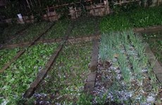
Mekong Delta seeks ways for climate change adaptation
As from now, the stability of geomorphology and sea level rise will be
calculated when devising economic projects and plans in coastal and
estuary areas in the Mekong Delta.
As from now, the stability of geomorphology and sea level rise will be
calculated when devising economic projects and plans in coastal and
estuary areas in the Mekong Delta.
According to the Southwestern Steering Committee, the move aims to cope with climate change, which is forecast to affect natural and socio-economic environment in the country’s rice bowl in the next 50-60 years.
As part of the efforts, regional provinces will build large-scale maps featuring coastal and lowland areas, sub-regions based on rising sea levels and hydrographic and hydraulic areas in the sub-regions.
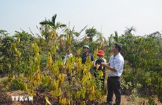
They will also make a list of infrastructure works which face the high risk of climate change and study new plant varieties highly resistant to salinity while upgrading sea and river dyke systems.
Besides, the localities build measures to protect production and infrastructure and evacuate people in vulnerable areas to safe places in case of calamity.
At the same time, they pay attention to information work and improving environmental management capacity while selecting high productivity and quality rice varieties which are resistant to salinity and adapt to climate change.
The Mekong Delta is one of the three most vulnerable delta belts that will face the onslaught and subsequent backlash of climate change in the world.
It is forecast that by the end of the century, sea water levels may rise by one metre – submerging 40 percent of the Mekong Delta, 11 percent of the Red River Delta and 3 percent of coastal provinces.-VNA
According to the Southwestern Steering Committee, the move aims to cope with climate change, which is forecast to affect natural and socio-economic environment in the country’s rice bowl in the next 50-60 years.
As part of the efforts, regional provinces will build large-scale maps featuring coastal and lowland areas, sub-regions based on rising sea levels and hydrographic and hydraulic areas in the sub-regions.
They will also make a list of infrastructure works which face the high risk of climate change and study new plant varieties highly resistant to salinity while upgrading sea and river dyke systems.
Besides, the localities build measures to protect production and infrastructure and evacuate people in vulnerable areas to safe places in case of calamity.
At the same time, they pay attention to information work and improving environmental management capacity while selecting high productivity and quality rice varieties which are resistant to salinity and adapt to climate change.
The Mekong Delta is one of the three most vulnerable delta belts that will face the onslaught and subsequent backlash of climate change in the world.
It is forecast that by the end of the century, sea water levels may rise by one metre – submerging 40 percent of the Mekong Delta, 11 percent of the Red River Delta and 3 percent of coastal provinces.-VNA


You should also see
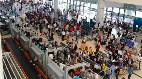
Airports to offer 9,000 domestic flights during upcoming holidays
Vietnamese airlines are expected to operate 9,000 flights on domestic routes to meet the travel demand during the upcoming National Reunification Day (April 30) and May Day (May 1) holidays, according to the Airports Corporation of Vietnam (ACV).

See more
 Environment
Heavy showers, hail hit Lao Cai
Heavy showers accompanied by hail suddenly poured down in the northern mountainous province of Lao Cai at around 6:30pm on April 24.
 Environment
Drought at peak dry season impacts over 20,000ha of farmland
About 20,090ha of farmland and over 2,600 households have been hit by drought and water scarcity in the central region, Central Highlands, and southeastern region, which are now in the peak period of the 2023 - 2024 dry season.
 Environment
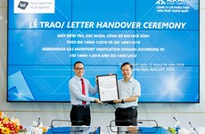
Hoa Phat steel products certified to meet greenhouse gas inventory standard
Vietnamese steel giant Hoa Phat Group has announced that BSI - the UK's leading international certification organisation - certified ISO 14064-1:2018 standard and ISO 14067:2018 on greenhouse gas inventory for steel products of its subsidiary - Hoa Phat Dung Quat Steel JSC.
 Environment
Vietnam supports global agreement on plastic pollution
A delegation of Vietnamese negotiators joined those from 176 countries worldwide at the fourth session of the Intergovernmental Negotiating Committee (INC-4) on plastic waste in Ottawa, Canada, on April 23.
 Environment
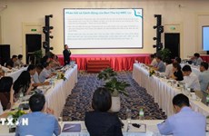
Consultation workshop on Cambodia’s Funan-Techo canal held in Can Tho
The Vietnam National Mekong Committee (VNMC) on April 23 held a consultation workshop on Cambodia’s proposed Funan-Techo canal project which has raised concerns about potential impacts on the Mekong river.