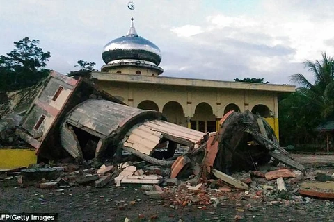
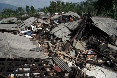
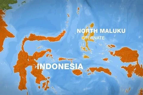
Jakarta (VNA) – A 5.9-magnitude aftershock shook Indonesia’s North Maluku province on November 15 after a strong quake hit the area in theearly morning of the same day.
According to Indonesia’s Meteorology, Climate and Geophysics Agency, the aftershock was centered about 140km northwest of Halmahera island and 10km deep under the ocean.
No tsunami warning was given. The agency said local residents in North Sulawesi also felt the shake.
Earlier, a 7.1-magnitude quake struck the area near Ternate city of North Maluku province.
The US Geological Survey (USGS) reported the quake was centred in the sea about 140 kilometres northwest of Ternate. The agency gave no tsunami alert.
Meanwhile, Indonesia’s Meteorology, Climate and Geophysics Agency issued a tsunami warning for North Sulawesi and North Maluku, but it was cancelled about two hours later.
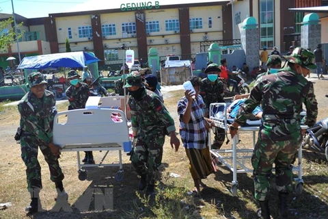
There have been no reports of casualties or damage.
Indonesia, one of the most natural disaster-prone nations on earth, straddles the Pacific “Ring of Fire”, where tectonic plates collide and large portion of the world’s volcanic eruptions and earthquakes occur.
A 7.5-magnitude quake and a subsequent tsunami in Palu on Sulawesi island in September 2018 killed more than 2,200 people, with over 1,000 more missing./.
According to Indonesia’s Meteorology, Climate and Geophysics Agency, the aftershock was centered about 140km northwest of Halmahera island and 10km deep under the ocean.
No tsunami warning was given. The agency said local residents in North Sulawesi also felt the shake.
Earlier, a 7.1-magnitude quake struck the area near Ternate city of North Maluku province.
The US Geological Survey (USGS) reported the quake was centred in the sea about 140 kilometres northwest of Ternate. The agency gave no tsunami alert.
Meanwhile, Indonesia’s Meteorology, Climate and Geophysics Agency issued a tsunami warning for North Sulawesi and North Maluku, but it was cancelled about two hours later.
There have been no reports of casualties or damage.
Indonesia, one of the most natural disaster-prone nations on earth, straddles the Pacific “Ring of Fire”, where tectonic plates collide and large portion of the world’s volcanic eruptions and earthquakes occur.
A 7.5-magnitude quake and a subsequent tsunami in Palu on Sulawesi island in September 2018 killed more than 2,200 people, with over 1,000 more missing./.
VNA