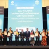
A project applying remote sensing technology in flood forecasts, warnings and monitoring in Vietnam proved effective, as heard at a seminar in Hanoi on March 12.
Adopting spatial-based and information & communications technology, the project ran from April 2011-March 2014 in northern Vietnam’s Red and Thao river basins.
Ha Hoa district in the northern midland province of Phu Tho was picked as a model to run a rain measuring station and an SMS system to alert village and commune chiefs about any disaster risks, said Yusuke Muraki from the Asian Development Bank.
Statistics showed that the maximum water level rise recorded during the project in the Thao River in Bao Ha district and Yen Bai city was 60 centimetres per hour and 40 centimetres per hour on August 18, 2012, respectively. In Phu Tho on July 26, 2012, it was 23 centimetres per hour.
Despite project progress, software technology used in flood alert and monitoring remains insufficient and low-quality in Vietnam, Dinh Thai Hung, a representative from the National Centre for Hydro-Meteorological Forecasting, told the seminar co-hosted by the centre and the Japan Aerospace Exploration Agency.
The project is part of a strategy to assist Vietnamese, Bangladeshi and Filipino governments in the effort.
According to the World Meteorological Organisation’s Asia Disaster Management Agency, Vietnam is among the countries most vulnerable to natural disasters in Asia.
With a 3,260-kilometre coastline, Vietnam is at risk of numerous calamities including flooding, rainstorms, drought, landslides, and whirlwinds. Flooding traditionally causes the most serious damage.-VNA