Downtown Ho Chi Minh M City will be transformed into a modern city centre with more green spaces, pedestrian-only streets and efficient public transportation means including trams, rapid bus transits and ferries.
Under a detailed plan unveiled by the city's Department of Planning and Architecture last week, the 930ha downtown area will be divided into five functional areas.
The first of these areas lies within District 1 and covers 92.3ha. This will be the central business district of HCM City with trade, hospitality and administration functions.
Together with underground metro stations, other underground spaces including walkways, shopping malls and car parks, this area will be developed along Le Loi and Nguyen Hue boulevards.
The second area, which also lies within District 1 and covers 212.2ha, will be home to cultural and historical sites in and surrounding Le Duan Street. This area currently has low construction density, so it will be developed to have more green spaces along Le Duan Street, which runs from the Reunification Palace to the Sai Gon Zoo.
Nguyen Thi Minh Khai Street has been targeted for high-density development.
The third area is a multi-functional area along the basin of the Sai Gon River , which covers 274.8ha. It stretches from Sai Gon Bridge to Tan Thuan Bridge, spanning Binh Thanh district and Districts 1 and 4.
Under the plan, many cultural, entertainment and public space will be developed in this area.
The fourth is the existing residential area with many French colonial villas that covers parts of Districts 1 and 3, stretching more than 232.3ha. Development in this area will be restricted in order to preserve the French-style villas.
The last area is adjacent to the first area to the south, where high-rise buildings of more than 200 metres will be allowed for development. The high-rise buildings will be developed near the Ben Thanh metro station, along Ham Nghi Street, Ben Nghe canal and Nguyen Thai Hoc street extension.
Under the plan, the city will become a more pedestrian friendly place. Major streets in the downtown area like the Nguyen Hue and Le Loi boulevards, Dong Khoi Street and part of Huynh Thuc Khang Street and Ben Thanh Market roundabout will become pedestrian areas.
Although the plan mentions no timeline, it says Vo Van Tan, Pham Ngoc Thach, Tran Cao Van and Pho Duc Chinh are also planned to become pedestrian-only streets.
The city will also have several footbridges at various locations.
Underground works at the city centre, which include metro stations, shopping malls, parking lots and walkways, will be connected from the September 23 Park-Ben Thanh metro station, Le Loi and Nguyen Hue boulevards and the HCM City Opera House metro station to Ton Duc Thang Street and Me Linh Square.
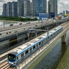
The city centre will also be connected with other public transport facilities including rapid bus transit services from District 4 to District 1 and from Ben Thanh metro station to District 7.
Besides, trams along the Sai Gon River will also be developed, connecting later with the Thanh Da peninsula in Binh Thanh district.
The plan envisages around 70ha of new green space, including parks along the Sai Gon River and within the city as well as trees planted along many streets.
Ho Quang Toan, Deputy Director of the city's Department of Planning and Architecture, said they have submitted the detailed plan to the HCM City People's Committee for approval.
Any project undertaken in the city centre must strictly conform to the plan, he added.-VNA


