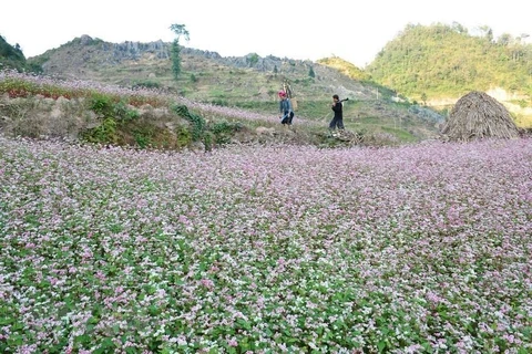
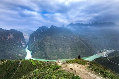
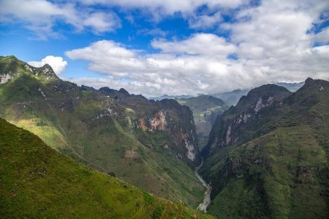
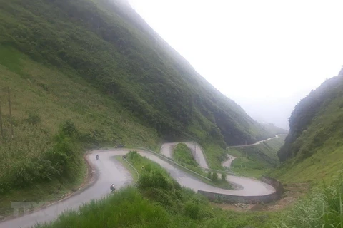
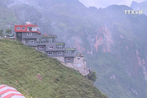
 The competition takes place at Tu San canyon where tourists can contemplate the spectacular beauty of mountains, deep green Nho Que River winding long pass foot, immense green corn fields or mossy stilt houses hidden in clouds and mountains. Ma Pi Leng is viewed the most dangerous mountain pass of Vietnam. Located in such a spectacular natural landscape, the Tu San canyon is deemed the highest and deepest one in Vietnam in particular and Southeast Asia in general. It is home to cliffs measuring up to 800m in height, 1.7km in length and 900m in depth, thereby one of the most outstanding destinations of Dong Van rock plateau. (Photo: VietnamPlus)
  About 80 boats joined in the competition, including 60 SUPs and 20 kayaks.
Formed millions of years ago, the Tu San canyon is believed to be a wonder of nature. Before, the site was deep under the sea water. During the change of the Earth’s crust, water subsided and made the site to be as it is today. Just some years ago, only few people could travel to the foot of the almost vertical Tu San canyon due to its arduous terrain, when the flow of the Nho Que river had yet to be blocked for the construction of a hydropower plant. Once the river’s flow was adjusted, Nho Que became a gentle reservoir, enabling people to use motorboats to reach the foot of the canyon (Photo: VietnamPlus)
 The competitors wear life vests to ensure safety. About 80 boats take part in the event, including 60 Stand-Up Paddleboard (SUPs) and 20 kayaks, which have gained more popularity in Vietnam’s mountainous tourist destinations. Hundreds of rowing-lovers from sup and kayak clubs nationwide have flocked to Meo Vac district of the northern province of Ha Giang. Tu San is believed to be the deepest canyon in Vietnam and the Southeast Asian region. It is home to cliffs measuring up to 800m in height, 1.7km in length and 900m in depth, thereby one of the most outstanding destinations of the Dong Van rock plateau (Photo: VietnamPlus)
  Competitors wear life vests to ensure safety. The road leading to the Nho Que reservoir from Ma Pi Leng mountain pass is about 12 km long. Travellers can go by motorbikes or cars for an estimated time of 30 minutes to reach the site, yet many experienced people advise tourists to travel by motorbikes or on foot because of the narrow, bumpy and winding trails. It is said to be a little tiresome, but once reaching the Nho Que reservoir, visitors will be overwhelmed and feel refreshed. They may join a boat trip and it takes them about 20 minutes to reach the spectacular and gigantic canyon (Photo: VietnamPlus)
  The race started from the Nho Que 1 hydropower plant to the Tu San canyon to Ta Lang village in Lai Lung commune. About 80 boats take part in the event, including 60 SUPs and 20 kayaks. Located in such a spectacular natural landscape, the Tu San canyon is deemed the highest and deepest one in Vietnam in particular and Southeast Asia in general. Going to Ha Giang in February or March, travelers will have a chance to witness a wondrous scene of nature, featuring the colour of red of cotton trees (scientifically known as Bombax ceiba) on both riverbanks, along with the deep green of water surface and the rust-red colour of soil in the middle of white limestone mountains (Photo: VietnamPlus)
  The race started from the Nho Que 1 hydropower plant to the Tu San canyon to Ta Lang village, Lai Lung commune. Formed millions years ago, Tu San canyon is believed to be a wonder of nature. Before, the site was deep under the sea water. Just some years ago, few people could travel to the foot of the almost vertical Tu San canyon due to its arduous terrain, when the flow of the Nho Que river had yet to be blocked for the construction of a hydropower plant. Once the river’s flow was adjusted, the Nho Que river became a gentle reservoir, enabling people to use motorboats to reach the foot of the canyon (Photo: VietnamPlus)
  A group of rowers rejoice at the completion of more than 6km journey from the Nho Que 1 hydropower plant through the Tu San canyon to Ta Lang village, Lai Lung commune and vice versa. Their sense of fulfilment is understandable as the route is famous for its arduous and challenging terrain. Going to Ha Giang in February or March, travelers will be able to witness a wondrous scene of nature, featuring the colour of red of cotton trees (scientifically known as Bombax ceiba) on both riverbanks, along with the deep green of water surface and the rust-red colour of soil in the middle of white limestone mountains (Photo: VietnamPlus)
  The event offers a chance for not only SUP and kayak rowers from all parts of the country to compete, but also all Vietnamese rowing lovers to share their love for the water sport. Participants may feel a sense of fulfilment when finishing the race as the route is famous for its arduous and challenging terrain. Non-competitive rowing has become more popular in Vietnam, resulting in the establishment of SUP and kayak clubs nationwide. Many tourist destination attractions across the country offer this kind of services, including those in Mai Chau and Da Bac of Hoa Binh and Tam Coc in Ninh Binh, among others (Photo: VietnamPlus)
  Two rowers at the competition. The race started from the Nho Que 1 hydropower plant to the Tu San canyon to Ta Lang village in Lai Lung commune. Formed millions of years ago, the Tu San canyon is believed to be a wonder of nature. Just some years ago, few people could travel to the foot of the almost vertical Tu San canyon due to its arduous terrain, when the flow of the Nho Que river had yet to be blocked for the construction of a hydropower plant. Once the river’s flow was adjusted, the Nho Que river became a gentle reservoir, enabling people to use motorboats to reach the foot of the canyon (Photo: VietnamPlus)
  Singer Thai Thuy Linh performs on a floating stage set up at the centre of the reservoir of Tu San canyon at the end of the competition. The performance is a highlight of the event, helping participants to relax and regain their energy after a fierce boat race. Located in such a spectacular natural landscape, theTu San canyon is deemed the highest and deepest one in Vietnam in particular and Southeast Asia in general. The race started from the Nho Que 1 hydropower plant through the Tu San canyon to Ta Lang village in Lai Lung commune. About 80 boats take part in the event, including 60 SUPs and 20 kayaks (Photo: VietnamPlus)
  Delegates, rowers and tourists join a fundraising campaign in Meo Vac district to support people in the central region affected by recent storms and floods. The aid will be delivered to people in need as soon as possible. Some 150,000 flood survivors in central Vietnam will be in urgent need of food over the next five to six months, while 110,000 vulnerable people will require support to recover their livelihoods and agricultural production. As of October 23, flooding left 117 dead and 21 missing, damaged over 37,500 houses, inundated 533ha of rice and more than 3,800ha of vegetables, and washed away over 6,100 cattle and 740,000 heads of poultry (Photo: VietnamPlus)
 VNA
