Hydro-meteorological sector seeks stronger links with partners

Hydro-meteorological sector seeks stronger links with development partners

Hydrometeorology is a borderless issue, so to minimise natural disaster-related losses and risks, close cooperation among countries around the world is needed, head of the Vietnamese hydro-meteorological administration has said.
Hydro-meteorological sector seeks stronger links with development partners ảnh 1
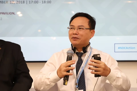
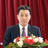
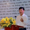
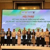
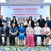
General Director of the Vietnam Meteorological and Hydrological Administration Tran Hong Thai speaks at the conference in Hanoi on September 18 (Photo: dangcongsan.vn)

Hanoi (VNA) – Hydrometeorology is a borderless issue, so to minimise naturaldisaster-related losses and risks, close cooperation among countries around theworld is needed, head of the Vietnamese hydro-meteorological administration hassaid.

At a conference in Hanoi on September 18,General Director of the Vietnam Meteorological and Hydrological AdministrationTran Hong Thai said over the last five years, cooperation between hisadministration and development partners has been growing, generating positiveoutcomes.

He underlined the need to enhancehydro-meteorological cooperation among countries around the world throughbuilding capacity, transferring technology, and sharing forecasts, statisticsand climate change knowledge.

Expanding cooperation in hydrometeorology isessential for development, Thai said.

Vietnamese DeputyMinister of Natural Resources and Environment Le Cong Thanh said one of thebiggest challenges to Vietnam’s hydro-meteorological sector is climate change.Therefore, it is necessary to build a concrete development strategy for ituntil 2030, with a vision to 2050.

Besides, development partners’ role in itstargets and development strategies need to maximise resources and preventwastefulness. It is also important for the sector to have open dialogues with Stateagencies, private companies that use hydro-meteorological services anddevelopment partners to enhance private parties’ engagement in this field.

He also highlighted the necessity to utilisebilateral and multilateral relations to modernise the country’shydro-meteorological sector.

According to Thai, under the sector’sdevelopment strategy until 2020, a system with 10 modern radars and a lightningdetection network with 18 stations nationwide have been installed. Dataintegration and supercomputer systems are also hoped to become operationalsoon.

However, the sector still needs more investmentfor the next 10-20 years to meet requirements relevant to disaster preventionand mitigation, socio-economic development, defence-security ensuring,reasonable natural resource exploitation and environmental protection.

The conference was attended by representativesof the World Bank, the Italian and Finnish embassies, development partners, anddomestic and foreign private companies. They learned about the Vietnamesesector’s development demand for 2020-2030 and pinpointed potential sponsors tohelp the sector realise its goals./.
VNA

See more

High waves in Ly Son island, Quang Ngai province due to Typhoon Kalmaegi. (Photo: VNA)

Central, Central Highlands localities respond to Typhoon Kalmaegi

As Typhoon Kalmaegi, the 13th storm to hit the East Sea this year, intensifies and heads toward Vietnam’s central coast, localities across the central and Central Highlands regions, including Dak Lak, Lam Dong, Da Nang and Quang Ngai, have activated their highest-level disaster response measures to ensure the safety of people and property.

A map released at 2pm on November 4, tracking the path of Typhoon Kalmaegi (Source: National Centre for Hydro-Meteorological Forecasting)

PM urges proactive measures in response to Typhoon Kalmaegi

As Typhoon Kalmaegi is expected to enter the East Sea on the morning of November 5, with sustained winds of level 13–14 and gusts reaching level 17, Prime Minister Pham Minh Chinh has ordered ministries, sectors, and local authorities to implement the highest-level response measures to protect lives and minimise damage.

Residents in the buffer zone of the UNESCO-recognised Western Nghe An Biosphere Reserve (Photo: VNA)

Vietnam's World Biosphere Reserves eye to become ideal destinations

Vietnam's World Biosphere Reserves have truly become a rendezvous for integration, cooperation, and the exchange of information and experiences among countries and international organisations in the field of conservation and sustainable development, as well as an ideal destination for domestic and international tourists, heard a conference in the central province of Khanh Hoa on November 3.

Heavy rain and prolonged flooding have caused deep inundation, making transportation difficult. (Photo: VNA)

Heavy downpours, floods leave 37 dead, five missing

In addition, floods have submerged and damaged 7,897 hectares of paddy and crops, and 64,356 livestock and poultry have died or been swept away. Across the nation, 103 houses have collapsed or been washed away, 451 others damaged, and 12,676 flooded.

Heavy rain causes severe flooding on many roads across Nghe An province on November 3. (Photo: VNA)

Storm Kalmaegi intensifies, authorities warn of flooding and landslides

From early November 3 to late November 4, areas from Ha Tinh to Da Nang and eastern Quang Ngai are expected to experience very heavy rainfall — 200–300mm on average, and up to 600mm in some places. Areas in Ha Tinh province, the northern part of Quang Tri province, and the eastern part of Quang Ngai province may see 100–200mm of rain, with localised totals exceeding 350mm.

Farmers harvest rice in the Mekong Delta. (Photo: VNA)

Agricultural sector to cut at least 15% greenhouse gas emissions by 2035

The project on low-emission crop production for the period for 2025-2035, with a vision extending to 2050, focuses on high-emission crops such as rice, cassava, sugarcane, coffee, and bananas. It aims to pilot at least 15 farming models nationwide that are ready for carbon credits and meet international standards.

Soldiers transport rice to distribute to flood-hit residents on October 31. (Photo: VNA)

PM orders urgent support for flood-hit localities

To ensure residents' safety and prevent hunger and disease outbreaks, the PM asked the Minister of Finance to immediately allocate rice from national reserves to flood-hit communities, based on requests from provincial authorities, including Quang Ngai. Implementation results should be reported to the PM by October 31.

High tides hit many areas in Can Tho city. (Photo: VNA)

JICA provides over 9 billion VND to help Can Tho improve drainage system

Japan's Fukuoka city will share its experience and advanced technologies to help Can Tho tackle three major issues: flood damage and untreated wastewater discharge, inefficient management of wastewater treatment plants, and low public awareness about connecting private drains to public systems.

The rising water level on Ve river (Photo: VNA)

Central Vietnam hit by torrential rains till late October

The deluge stems from a combination of atmospheric factors, including a low-altitude cold air mass, a northward movement of the intertropical convergence zone and humid easterly winds at elevations between 1,500m and 5,000m, NCHMF Director Assoc. Prof Mai Van Khiem said, adding that this configuration is a classic driver of prolonged, high-intensity rainfall in the region.

A flooded area in the central region (Photo: VNA)

Record-breaking floods loom on Vu Gia–Thu Bon rivers

The meteorological agency has issued a warning of prolonged and widespread flooding in low-lying and riverside areas, with severe inundation expected in urban zones in Da Nang. There is also a high risk of flash floods and landslides in the mountainous areas of Da Nang city.

The 254 lane, Pham Chau Trinh street in Hue is heavily flooded dueto torrential rain (Photo: VNA)

Heavy rain and rising floods hit central region of Vietnam

From late October 26 to the early hours of October 27, areas stretching from Hue city to Quang Ngai province experienced heavy to extremely heavy rainfall, with some places recording over 100mm. The Bach Ma station in Hue measured 119.8mm, while the Rach Bun station in Dong Thap recorded 165.8mm.