Vietnam, Japan discuss new approaches to reduce natural disaster risks

The Ministry of Agriculture and Rural Development and Japan’s Ministry of Land, Infrastructure, Transport and Tourism (MLIT) on November 28 organised the 12th Vietnam-Japan disaster management cooperation dialogue, discussing new approaches to flood reduction using risk information.

Director of the Department of Dike Management and Disaster Prevention Pham Duc Luan speaks at the event. (Photo: VNA)

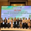
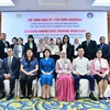
Hanoi (VNA) – The Ministry of Agriculture and Rural Development and Japan’s Ministry of Land, Infrastructure, Transport and Tourism (MLIT) on November 28 organised the 12th Vietnam-Japan disaster management cooperation dialogue, discussing new approaches to flood reduction using risk information.

The dialogue brought together representatives from Departments of Agriculture and Rural Development of northern and central provinces and cities in Vietnam.

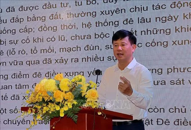
Speaking at the event, Director of the Department of Dike Management and Disaster Prevention Pham Duc Luan said that the dialogue provided an opportunity for Vietnamese and Japanese experts to exchange experiences, find solutions to minimise the risk of natural disasters, particularly floods and landslides.

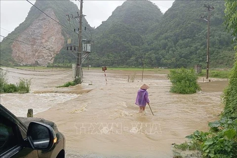
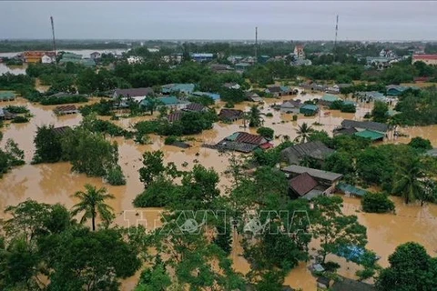
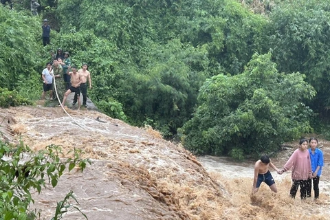
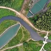
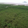
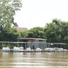
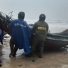
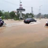
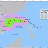
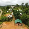
Nguyen Xuan Tung, an officer from the department said that Vietnam is vulnerable to many kinds of natural disasters, especially floods which occur in all three regions across the country.

To minimise damage caused by floods, he pointed to the need to improve the legal framework and policies on natural disaster prevention and control, raise public awareness on natural disasters, strengthen community-based risk management, and enhance capacity of natural disaster prevention, control, search and rescue.

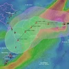
At the event, Mizushima Yusuke from Department of International Affairs, the MLIT’s Bureau of Water and Disaster Management said that in Japan, information on natural disaster risk is available on the ministry’s disaster risk map portal.

This map will show the frequency of floods and flood water levels. In addition, authorities guide people to move to areas with lower risk.

In Japan, it is mandatory to present a disaster risk map when conducting real estate transactions and provide information on the location of the relevant real estate. Authorities must develop evacuation plans.

According to him, the Japanese government is launching an initiative urging people to call and inform their families or relatives to promptly evacuate and respond to risk warnings in the areas where they live when a natural disaster happens.

Minamitani Taichi from the Department of Global Environment under the Japan International Cooperation Agency said that Vietnam and Japan have been coordinating in several flood management projects.

He noted that it is important to conduct flood risk assessment, develop integrated flood management planning, response plans, and an early warning system, and strengthen capacity-building.

Participants also proposed that Japan coordinate and support Vietnamese localities in building natural disaster maps, particularly floods and landslides/.

VNA

See more

Sarus cranes at Tram Chim National Park (Photo: VNA)

Return of sarus cranes: Hope takes wing in Dong Thap wetland

Beneath the wide Mekong Delta sky, Tram Chim National Park is racing against time, pouring heart and science into a decade-long (2022–2032) plan to rescue the Eastern sarus crane – an elegant, scarlet-headed bird listed as endangered on the International Union for the Conservation of Nature (IUCN) Red List and a living emblem of both the park and all of Dong Thap province

French Ambassador Olivier Brochet speaks at the press conference in Hanoi on December 11 to mark the 10th anniversary of the Paris Agreement on climate change and highlighting the COP30 outcomes. (Photo: VNA)

International community ready to support Vietnam in energy transition, climate response

In a video message to the press conference, UN Resident Coordinator in Vietnam Pauline Tamesis said the UN is ready to support Vietnam in building a pipeline of projects capable of absorbing financing mobilised under the Political Declaration on establishing the Just Energy Transition Partnership (JETP), as well as from global climate finance sources, including the Green Climate Fund and the Loss and Damage Fund.

Forest rangers in Son La province apply technological devices and software to forest management, monitoring, and protection. (Photo: nhandan.vn)

Digital technology application enhances forest management, protection

With a total forest area of over 14 million hectares, including more than 10 million hectares of natural forests, forests exist in all 34 provinces and cities across the country. Given the large area and limited workforce, applying digital solutions in forest management and protection has become a top priority for the forestry sector.

Sunda pangolins (Manis javanica), also known as the Javan pangolin, are listed in Group IB – critically endangered and strictly protected from all commercial exploitation (Photo: VNA)

Quang Ngai releases rare pangolin back into nature

Initial verification showed that the animal weighed 3.7kg and measured over 60cm. It was identified as a Sunda pangolin (Manis javanica), also known as the Javan pangolin, listed in Group IB – critically endangered and strictly protected from all commercial exploitation.

Residents of Tuyen Quang province take part in the One Billion Trees Programme. (Photo: VNA)

Tree-planting programme exceeds one-billion-tree goal

The total comprises 573.9 million scattered trees and 865.2 million trees grown in concentrated plantations, equivalent to 429,125 hectares of forest. Provinces posting the strongest results include Phu Tho with 177.9 million trees, Lao Cai with 108.8 million, and An Giang with 98.5 million.

Construction activity is one of the causes of air pollution in Hanoi. (Photo: VNA)

Hanoi takes urgent measures to curb air pollution

The city requires the enhanced application of advanced technologies and remote monitoring systems, including satellite remote sensing, drones, and AI-integrated traffic cameras, to monitor, detect, and strictly address the illegal burning of garbage, straw, and agricultural by-products.

The World Bank delegation holds working session with Can Tho city People's Committee and relevant units (Photo: VNA)

World Bank delegation surveys Can Tho urban resilience project

The project is jointly financed by the WB with up to 250 million USD and a 10-million-USD non-refundable grant from the Swiss State Secretariat for Economic Affairs (SECO), along with counterpart funding from the Vietnamese Government. Its goal is to build a climate-resilient and sustainable city that can drive socio-economic growth across the Mekong Delta, mitigate flood vulnerability in central Can Tho, and improve inter- and intra-regional transport connectivity.