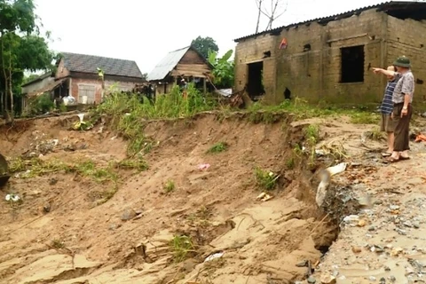
Dong Thap (VNA) – The Mekong Delta province of Dong Thap is forecast to suffer more landslides along the Tien river, which cost more than 290ha of land together with 320 billion VND (13.91 million USD) used for relocating the displaced locals in 2005-2016.
Since early this year, three landslide cases have hit Long Thuan commune, Hong Ngu district, stretching an area of 1,630 sq.m with a length of 116m and a depth of 10-20m, damaging two fishing vessels and causing a loss of nearly 217 million VND (6,700 USD).
Since April, Binh Hoa village in Binh Thanh commune, Thanh Binh district, has suffered four extremely serious landslides which have torn away 1,959 sq. m of land, part of which is only 15-25m distant from National Highway 30.
Deputy Director of the provincial Department of Agriculture and Rural Development Vo Thanh Ngoan attributed the disaster to changing water flows and massive sand mining, fish farming, and housing construction along the riverbank.
Since 2016, 200 households have been relocated to safety areas, Ngoan said, adding that the province also directed relevant units to move remaining households living in landslide-prone areas to new residential clusters, accelerate the construction of landslide-proof works, and strengthen supervision on sand mining, especially in areas hard hit by the disaster.
The province also expects to receive more government’s funding sourced from the National Target Programme to speed up evacuation and support ongoing response efforts, he said.
Currently, up to 45 communes, wards and towns in 10 out of the locality’s 12 districts and cities have been hit by landslides.-VNA
source


