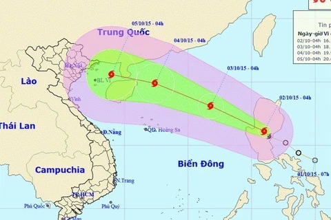
Hanoi (VNA) – A tropical low pressure the East Sea on June 11 grew into a tropical storm – the first in the sea this year, according to the National Hydro-meteorological Forecasting Centre.
At 1 pm, the storm was located 450km east of Vietnam’s Hoang Sa archipelago, with wind speed near the eye of the storm reaching 60-75km per hour.
In the next 24 hours, it will be moving north-northwest at a speed of 20km per hour.
The storm was to be spotted 300km east of Hong Kong (China) at 1 pm on June 12, with wind speed reaching 75-90km per hour.
On the next 24-48 hours, the storm will continue moving in the north-northwest direction at a speed of 15-20km per hour. It is forecast to hit Guangdong province of China, and weaken into a tropical low pressure.
The centre warned that the storm would bring heavy rain, strong thunderstorm and wind, and whirlwind for the south of the East Sea, including Truong Sa archipelago area and coastal localities from Ninh Thuan to Ca Mau, and from Ca Mau to Kien Giang, and Thailand Gulf.-VNA
VNA


