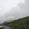
A fire that broke out in Hoang Lien National Park in the northern province of Lao Cai remains out of control as 500 people including forest rangers and locals struggle to put it out.
The fire started in Seo My Ty village in Sa Pa district, about 80km from Lao Cai City and over 40km from Sa Pa Town on March 2.
Part of the fire in Sa Pa district's Lao Chai commune was extinguished on March 4, but it has spread towards Ta Van commune's Den Thang hamlet and has so far remained out of control.
According to Nguyen Huy Minh, an official of Lao Cai province's Steering Committee for Forest Fire Control, it was difficult to handle the fire because of the lack of telecommunications coverage, strong winds and rough terrain.
The spots still on fire were 1,700-1,900m above sea level and would take hours to approach.
"It is impossible to contact those participating in the fire fight because there is no telecommunications coverage at that height," said Minh.
Light rain helped slow the fire from spreading on March 4, but that has since dispersed.
Fire crews are equipped with food, medicine, tools and fire prevention equipment to put out the fire.
Minh said modern equipment had not been used because the fire was not too dangerous.
So far there have been no related casualties or damage reported or confirmed by the local authorities, but the cause of the fire remains unknown.
Located 1,000-3000m high above sea level, the Hoang Lien National Park covers an area of nearly 30,000ha, spreading across six upland communes of Lao Cai province's Sa Pa district and Lai Chau province's Than Uyen district.
The park was recognised by the Association of Southeast Asian Nations (ASEAN) Secretariat as heritage site in 2006.
It is known for a diversity of animals and plants, including many rare species, and for being home to Fansipan, Indochina 's highest mountain at 3,143 metres.
In February 2010, 700ha of the forest burned down over a one-week period./.

