A document dated on July 19, 1838 under reign of King Minh Mang to ask for tax exemption for ships on missions to Hoang Sa (Source: Internet)
 Thua Thien-Hue (VNA) – The Nguyen Dynasty (1802-1945) delineated Vietnam’s territory spanning from the mainland to sea and islands, and continuously exercised the country’s maritime sovereignty.
Aware that the sea and islands were an important part of Vietnam, the dynasty issued and implemented a string of policies on military, national defence, foreign affairs and economy regarding sea and islands in an effort to protect and exploit this area, according to Dr. Phan Thanh Hai, Director of the Hue Relics Preservation Centre.
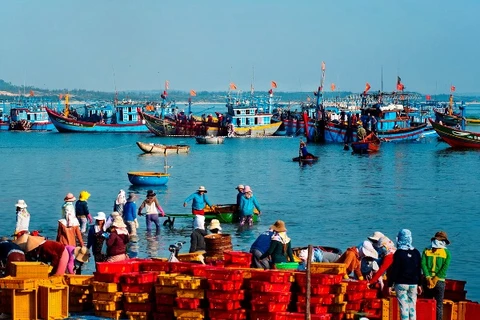
Such policies focused on coastal defence, naval force development, patrol activities, rescue operations and combat piracy.
A document relating to the Hoang Sa (Paracel) archipelago compiled 250 years ago was preserved in the communal house of My Loi village, Vinh My commune, Phu Loc district, in the central province of Thua Thien-Hue.
The document reveals that the Nguyen Dynasty sent forces to protect the archipelago hundreds of years ago. It was then handed over to the Ministry of Foreign Affairs as evidence proving Vietnam’s sovereignty over the archipelago.
Foreign scholars recorded that in 1816, under the reign of King Gia Long (1802-1820), there were a total of 1,482 ships in the royal naval fleet, including 490 warships, 77 great warships and 66 European-style ships. King Gia Long’s warships carried up to 22 guns.
J. White, a US national who visited the shipyards of King Gia Long in Sai Gon Port many times, praised Vietnamese shipbuilding skills and described the materials and equipment aboard the warships.
Such shipyards, located in the northeastern part of Sai Gon (now Ho Chi Minh City), could compete with the best shipyards in Europe, he said.
King Gia Long’s descendant - King Minh Mang heeded learning from the shipbuilding techniques of other countries in order to improve the transport and combat capacity of the royal naval power.
The numbers of the naval force increased from 17,000 men during the reign of King Gia Long to 28,600 during the reign of King Minh Mang.
Thanks to the King’s due attention to exercises and maritime patrols, the naval force became strong in the region, which could meet both fighting and trading requirements at sea.
King Minh Mang also issued various policies on ship management, patrols, rescue operations and pirate combat.
In 1876, King Tu Duc formed a patrol troop divided into two groups in charge of defending the country’s sea waters and fighting pirates.
It can be said that the Nguyen Kings were well aware that the sea and islands were significant to the existence of the dynasty, as well as to national security and the whole people.
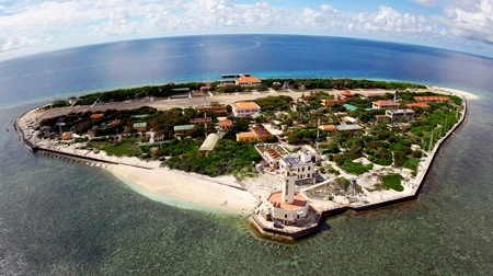
The Hoang Sa archipelago housed a Vietnamese meteorological station which operated from 1938 to 1947 and was internationally coded 48-860.
Under the Nguyen Dynasty, the archipelago belonged to Quang Ngai district, in the central province of Quang Nam. It then became part of Thua Thien province in 1938, and Quang Nam province’s Hoa Vang district in 1961. In 1982, the Vietnamese Government decided to establish Hoang Sa district in Quang Nam-Da Nang province, presently known as Hoang Sa district in Da Nang city.
In 1956, China occupied the eastern part of Vietnam’s Hoang Sa archipelago. In January 1974, the neighbouring country took advantage of the context that the Vietnamese army and people were focusing efforts on the war against US forces to gain control over the entire archipelago.
Clearly, Vietnam’s sovereignty over the Hoang Sa and Truong Sa (Spratly) archipelagoes was continuously and fully established and exercised without disputes.-VNA