Reducing coastal disaster risks in Vietnam: accurate forecasts imperative

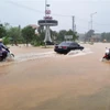
The escalating impacts of climate change have made natural disasters, especially storms, increasingly unpredictable. Against this backdrop, accurate and strategic forecasting of disaster risk levels is now imperative to mitigate losses effectively and ensure sustainable coastal development.

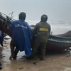
01 ttxvn-bac-lieu-sat-lo-tiep-tuc-xay-ra-tren-tuyen-de-bien-dong-0608-2-6501.jpg
(Illustrative image. Source: VNA)

Hanoi (VNA) - The escalating impacts of climate change have made natural disasters, especially storms, increasingly unpredictable. Against this backdrop, accurate and strategic forecasting of disaster risk levels is now imperative to mitigate losses effectively and ensure sustainable coastal development.

According to the Ministry of Natural Resources and Environment (MoNRE), establishing different warning levels for natural disasters will help localities minimise impacts and overcome the consequences of natural disasters in a more reasonable and effective manner.

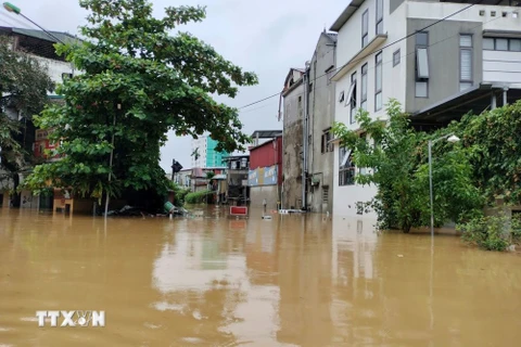
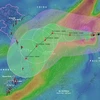
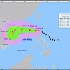
Vietnam's coastal provinces play a pivotal role in national socio-economic growth, yet they remain the most affected by extreme weather events. Over recent years, major storms, including Washi (2005), Damrey (2005), Kalmaegi (2014), Doksuri (2017), and Vamco (2020), have caused widespread flooding and extensive damage in coastal areas, particularly when they coincided with high tides, leading to dike breaches and severe inundations.

According to Dr. Nguyen Quoc Khanh, Deputy Director of the Institute of Hydrometeorology and Climate Change, climate change and rising sea levels also tend to increase in frequency, duration and intensity, worsening coastal erosion, saltwater intrusion, and flooding. A 2020 climate change scenario predicted that a 100cm rise in sea level could submerge 30-80% of the Mekong Delta and 20-40% of the Red River Delta, affecting millions of residents and critical infrastructure.

A study conducted by World Bank and Global Facility for Disaster Reduction and Recovery in 2020 estimated that approximately 11.8 million people in Vietnam's coastal areas would be directly affected by floods, with potential economic loss of 1 million USD in agricultural GDP. In addition, 42% of coastal hotels are located in landslide areas, half of industrial zones are at risk of being affected by major floods and 22% of schools and 26% of medical facilities are at risk of being affected by major flooding.

Dr. Khanh emphasizes the necessity of a comprehensive strategy to forecast disaster risks at varying levels. Such an approach would provide a foundation for preventive measures, emergency responses, and post-disaster recovery.

He said it is crucial to tailor risk assessments to local conditions. “At the same height, the risk levels due to sea level rise for coastal areas will be different depending on local factors such as terrain, infrastructure, resilience and response capacity. This requires detailed building for risk levels based on local characteristics,” Khanh said.

The Institute of Hydrometeorology and Climate Change is conducting a number of ministerial and state-level projects on decentralisation and risk assessment of natural disasters in Vietnam.

It is researching and building a system to warn of the risk levels of typhoons and tropical depressions according to hydrometeorological forecasts and applying them on a trial basis in the north central region.

The IMHCC was also researching scientific and technological solutions for multi-disaster management, building support tools for coastal areas, assessing the increasing level of natural disaster risks.

"Urgent solutions to prevent natural disaster risks include improving the effectiveness of marine hydrometeorology forecasting and warning; consolidating and upgrading the sea dyke system, ensuring resilience to frequent typhoons; increasing the amount of wave-breaking trees, developing protective forests and mangrove forests at river mouths and along the coast, and preserving natural coastal sand dunes," Khanh said.

02 trong-cay-ven-bien-8799.jpg
Expanding mangrove forests, maintaining natural sand dunes, and planting wave-resistant vegetation along river mouths and coasts. (Photo: VNA)

He said that to upgrade and innovate the warning system, MoNRE proposed applying advanced technologies such as AI to improve the disaster forecasting accuracy, especially for floods and landslides.

More automatic monitoring stations with new technology should be added, especially in vulnerable areas, to ensure accurate and timely data collection and a disaster warning information system should be built in.

In addition, concerned agencies needed to develop education and communication programmes on climate change and natural disaster risks to raise people's awareness of self-prevention and protective measures against natural disasters.

They must review local planning and strategies including planning on infrastructure, land use, population and natural disaster prevention, especially in areas heavily affected by recent typhoons./.

See more

A rare turtle is transported to Cuc Phuong National Park for care and rehabilitation ahead of its eventual release back into the wild. (Photo published by VNA)

Rare turtles returned to Vietnam under CITES

The shipment includes several endangered Vietnamese species such as the Indochinese box turtle (Cuora galbinifrons), Bourret’s box turtle (Cuora bourreti), keeled box turtle (Cuora mouhotii), and black-breasted leaf turtle (Geoemyda spengleri), all considered highly endangered and increasingly threatened in the wild by habitat destruction, poaching, and illegal trade.

Representatives of the Ngoc Lam Border Guard Station under the Nghe An Border Guard Command and Son Lam commune's police hand over a pangolin voluntarily surrendered by a local resident to the wildlife conservation centre at Pu Mat National Park. (Photo: VNA)

Nghe An residents voluntarily hand over rare pangolins for conservation

On May 11, the Quy Chau Forest Protection Department, along with local police and authorities, took in a critically endangered pangolin, handed over by a resident. The animal was discovered a day earlier by Thai Doan Tuan, from Viet Huong village in Quy Chau commune, after it wandered into his garden. Recognising it as a protected Sunda pangolin, he contacted authorities for assistance.

A 2kg pangolin is released back into the wild at the Pu Huong Nature Reserve on May 6, 2026. (Photo published by VNA)

Nghe An releases rare pangolin back to the wild

Pangolins, scaly mammals capable of curling into a ball for self-defence, are classified as critically endangered and are strictly protected under both Vietnamese and international law.

At the working session (Photo: Vietnam Meteorological and Hydrological Administration)

Vietnam, Sri Lanka share experience in hydrometeorology

Both sides expressed confidence that continued dialogue and knowledge-sharing will deepen cooperation in hydrometeorology, helping enhance disaster response capacity and climate change adaptation in the years ahead.

Chac Den Cave was recently discovered in Phong Nha - Ke Bang National Park in Quang Tri province. (Photo: VNA)

26 new caves discovered in Phong Nha – Ke Bang National Park

The new findings comprise several large caves with complex structures and high scientific value, including Thien Cung Cave, measuring 4,206 metres – the longest cave identified during the survey, Nuoc Lan Cave (2,721 metres), Ma Dom Cave (1,257 metres) and Cha Ngheo Cave (583 metres).

Nine Sunda pangolins (Manis javanica) have been released back into the wild at the Bach Ma National Park. (Photo: VNA)

Nine endangered Sunda pangolins returned to nature in Hue

Before their release, the animals had undergone quarantine, care, rehabilitation and close monitoring by technical staff and veterinarians to ensure they were in good health and capable of returning to their natural habitat.

Thailand ready to share experience with Vietnam in green urban development: officials

Thailand ready to share experience with Vietnam in green urban development: officials

Thailand is ready to share its experience and successful models in green urban development with Vietnam, as the two countries share many similar characteristics, including rapid urbanisation, traffic congestion, flooding, canal networks and growing demand for greener public spaces, Thai officials have said in recent interviews with the Vietnam News Agency.

This May marks the third time the country’s largest wildlife bird photography competition has been held. (Photo: Vietnam BirdRace 2026 organising committee)

Vietnam BirdRace 2026 to attract hundreds of photographers worldwide

Participating teams, each comprising three to four members, are tasked with photographing as many wild bird species as possible within the official competition period. While artistic quality is not mandatory, images must be clear enough for species identification, ensuring authenticity and avoiding any disturbance to natural habitats.