Vientiane (VNA) - The Republic of Korea has granted more than 49.7 billion kip (6 million USD) through the Korea International Cooperation Agency (KOICA) to finance a project that will strengthen geospatial data in the Lao province of Savannakhet.
The Project for the Establishment of Geospatial Data Infrastructure and Capacity Building for Developing Special Economic Zone in Savannakhet province aims to create a large-scale digital topographic map for use in socio-economic development in the province, the English-language newspaper Vientiane Times reported.
The project will also build the capacity of officials and provide technical support so that Lao officials can create topographic maps themselves.
It will also support the government’s socio-economic development plan, especially the development of infrastructure including roads, electricity, water supply, and urban planning.
The RoK is also providing mapping information, equipment and vehicles for use in the project.
The four-year project runs from 2018 to 2021. This is the second phase and follows on from the successful digital topographic mapping and capacity building project carried out in Vientiane from 2014 to 2017.
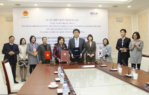
The project agreement was signed in Vientiane on March 14 by Khongkham Souliya, Director General of the Survey and Mapping Department, Ministry of Home Affairs, and Sung-soo Oh, a representative of the KOICA office in Laos.
Apart from this project, KOICA is currently operating 12 projects in Laos, mainly in the sectors of health, rural development, education, and energy. - VNA
The Project for the Establishment of Geospatial Data Infrastructure and Capacity Building for Developing Special Economic Zone in Savannakhet province aims to create a large-scale digital topographic map for use in socio-economic development in the province, the English-language newspaper Vientiane Times reported.
The project will also build the capacity of officials and provide technical support so that Lao officials can create topographic maps themselves.
It will also support the government’s socio-economic development plan, especially the development of infrastructure including roads, electricity, water supply, and urban planning.
The RoK is also providing mapping information, equipment and vehicles for use in the project.
The four-year project runs from 2018 to 2021. This is the second phase and follows on from the successful digital topographic mapping and capacity building project carried out in Vientiane from 2014 to 2017.
The project agreement was signed in Vientiane on March 14 by Khongkham Souliya, Director General of the Survey and Mapping Department, Ministry of Home Affairs, and Sung-soo Oh, a representative of the KOICA office in Laos.
Apart from this project, KOICA is currently operating 12 projects in Laos, mainly in the sectors of health, rural development, education, and energy. - VNA
VNA