Hanoi (VNA) - Vietnam's geographic location near several fault lines puts it at risk for moderate to severe earthquakes, according to seismologists.
Last month, six small earthquakes were reported in the A Luoi region in central Thua Thien Hue Province. Prior to that, a quake on May 15, 2014 measured 4.7 on the Richter scale.
Professor Cao Dinh Trieu, an expert on earthquakes, said A Luoi is located in a fault region. The fault runs from northwest to southeast, starting in Laos and running through Thua Thien Hue Province to Binh Dinh Province in central Vietnam.
Agreeing with Professor Trieu, Professor Phan Trong Trinh, President of the Vietnam Academy of Science and Technology, said the fault in Thua Thien Hue was the cause of a series of tremors in the A Luoi region.
In addition, according to scientists from the Vietnam Federation of Geology, a moderate earthquake registering 5.7 on the Richter scale may occur in Thua Thien-Hue Province in the future.
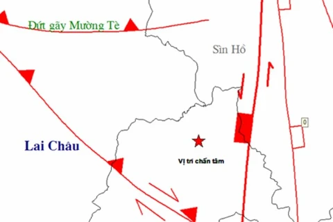
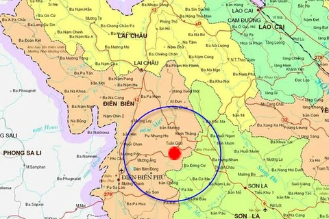
Many Vietnamese scientists who specialise in seismic forecasts said a major quake measuring more than 7 on the Richter scale may hit the northwestern region in the future.
They said several faults, particularly the Dien Bien and Song Da faults along the Ca River, have a tendency to gradually shift towards the Central Highlands and south central region. These are obvious indications that Vietnam is likely to be hit by strong quakes, which are often accompanied by a tsunami warning.
In 1935, a quake measuring 6.75 on the Richter scale hit Dien Bien Province, caused by the Song Ma fault. In 1983, another quake measuring 6.8 was reported in the Tuan Giao area of Dien Bien Province. Those two quakes caused extensive damage to personal property.
Although the consequences of earthquakes that hit Vietnam have not been serious in terms of human lives or property, adverse weather in recent years has raised alarms for Vietnam. Scientists warned that reliable and precise predictions of earthquakes and tsunamis are needed in order to prepare for the worst-case scenario.-VNA


