The southernmost province of Ca Mau , which is only one metre higher than sea level, could disappear in the next several decades due to land sinking unless groundwater exploitation stops.
This is the warning by experts from the Norwegian Geotechnical Institute (NGI) at a workshop in the Mekong Delta city of Can Tho on June 17.
Jointly organised by Vietnam’s Ministry of Agriculture and Rural Development (MARD) and the NGI, the event reviewed the first phase of a research project on land subsidence in Ca Mau province, which has been conducted since May, 2012 by NGI at the request of MARD and Norway’s Ministry of Foreign Affairs.
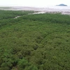
NGI experts said as the land surface in Ca Mau is only one metre higher than sea level, land sinking could be considered the cause of land erosion along the coastline, damage to mangrove forests and saltwater intrusion.
They said analysis of satellite data showed the coastline in Ca Mau has receded by between 100 metres to 1,400 metres over the last twenty years, while the land has sunken by 30 to 70cm in some places. They emphasised that the most practical way to stop this is to put an end to or limit the pumping of groundwater in the province.
PhD Tran Tan Van, Director of Geological Science and Mineral Institute said the subsidence speed in Ca Mau was about 1.56-2.30 cm per year, but the speed is much higher in urban areas where there is a large number water pumping stations. According to Van, there are more than 100,000 such stations in Ca Mau, extracting about 370,000 cu.m of water each day.
The Norwegian experts suggested the Vietnamese Government should be informed about the threat of subsidence facing Ca Mau and other provinces in the Mekong Delta region, so that it can take action to reduce damaging effects before it is too late.
The institute also called on the province to build dykes along the coastal areas in order to prevent soil depression, salt infiltration and soil erodent in the locality.
In the project’s second phase, NGI will draw a geological map of Ca Mau province, monitor the land subsidence situation and collect and analyse data on the sea level.-VNA


