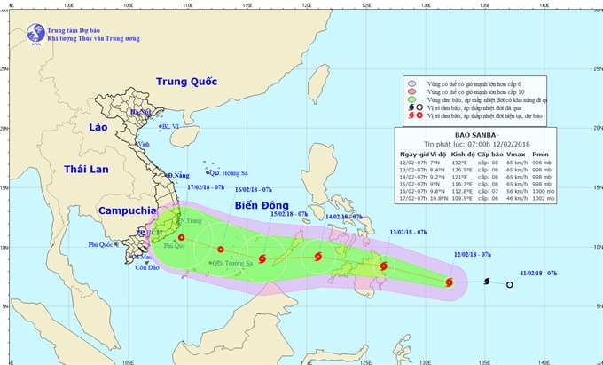
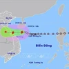
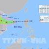
Moving path of the East Sea tropical low pressure (Photo: nchmf.gov.vn)
 Hanoi (VNA) - A low-pressure system near the Hoang Sa (Paracel) archipelago is likely to become a storm in the East Sea, according to the National Centre for Hydro-meteorological Forecasting.
At 2:30 pm on June 3, the tropical low pressure was about 220km to the south of Hoang Sa archipelago. Strongest winds near its centre were estimated at 40 - 60km per hour.
Over the next 24 hours, the tropical low pressure is forecast to move north at a speed of 10 km per hour and is likely to become a storm.
Its influence caused heavy rains, winds and cyclones on the waters off the coast of the central and southern regions from Ca Mau to Kien Giang provinces and in the Gulf of Thailand.
Over the following 24 – 48 hours, it will move north at a speed of about 10km per hour, with strongest winds near its centre estimated at 60 – 90 km per hour.
Over the next 72 hours, the system will move north - northwest at a speed of about 5 – 10 km per hour.
The National Centre for Hydro-meteorological Forecasting said the system caused normal and heavy rains in Quang Ngai and Binh Dinh, whose low areas are at high risk of landslides and fast floods.
According to the Quang Ngai steering board for natural disaster prevention and search-rescue mission, as of 7 am on June 3, a total of 1,160 fishing vessels with 9,359 labourers aboard were still at sea.-VNA
VNA