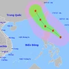
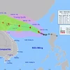
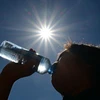
Typhoon Koto weakens, changes direction, continues to move slowly
In the next days, the typhoon will continue to move slowly westward, then possibly turn west-southwest at about 5km/h, continuing to weaken.
Due to the intensified cold spell, the northern region, and the north-central provinces of Thanh Hoa and Nghe An are predicted to experience showers, with some areas likely to record thunderstorms.
Between the night of November 17 and 19, the North will also experience rain. The combination of rain and strong cold air will cause a sharp drop in temperatures across the northern region and the provinces of Thanh Hoa, Nghe An and Ha Tinh.
Kalmaegi is a strong and fast-moving storm with a broad circulation, with a track and pattern of impact similar to Typhoon Damrey (2017) and Typhoon Molave (2020).
By 1:00 am on November 7, the typhoon is predicted to make landfall along the coast from Quang Ngai to Dak Lak, sustaining winds at Level 12 with gusts up to Level 15.
Typhoon Kalmaegi has intensified as it is moving rapidly towards the central East Sea, bringing the risk of strong winds, heavy rain, and high waves to Vietnam’s central region in the coming days.
From early November 3 to late November 4, areas from Ha Tinh to Da Nang and eastern Quang Ngai are expected to experience very heavy rainfall — 200–300mm on average, and up to 600mm in some places. Areas in Ha Tinh province, the northern part of Quang Tri province, and the eastern part of Quang Ngai province may see 100–200mm of rain, with localised totals exceeding 350mm.
The deluge stems from a combination of atmospheric factors, including a low-altitude cold air mass, a northward movement of the intertropical convergence zone and humid easterly winds at elevations between 1,500m and 5,000m, NCHMF Director Assoc. Prof Mai Van Khiem said, adding that this configuration is a classic driver of prolonged, high-intensity rainfall in the region.
Heavy rain in the central region may persist until the end of October, with high risks of flash floods, landslides in mountainous areas, and flooding in low-lying and urban zones.
Storm Fengshen has continued to change its moving direction, causing strong winds and high waves in the northern part of the East Sea, seriously affecting vessels operating in this area.
The NCHF warned about heavy rainfall of more than 70mm in three hours accompanied by whirlwinds, lightning, hailstorm, and gales, in the regions.
Experts emphasised that while natural disasters cannot be avoided, effective mitigation and adaptation are vital to safeguard lives, property, and economic activities. Public awareness and preparedness, they said, are key to reducing vulnerability.
Lam said that Hanoi is likely to see widespread precipitation ranging from 50-100 mm, and isolated areas potentially receiving over 150 mm. Thunderstorms may also bring the risk of strong winds, lightning, and gusts, he added.
Forecasters said that by late October 6, Typhoon Matmo will continue moving west-northwest into northern mountainous areas of Vietnam and weaken further into a tropical depression with winds below level 6. Quang Ninh and Lang Son provinces are expected to be the most directly affected.
Bualoi is moving almost twice the average speed of a typical typhoon in the region, and may cause multiple disaster conditions such as strong winds, torrential rain, flash floods, landslides, and coastal flooding.
Deputy Minister of Agriculture and Environment Nguyen Hoang Hiep emphasised that the fast pace of the storm requires more urgent response measures at sea. He urged coastal provinces to hasten the withdrawal of vessels from hazardous areas and issue sea bans earlier, even 48 hours ahead of its landfall.
By 7:00 on September 28, Typhoon Bualoi’s centre will continue moving west-northwest at around 30 km/h and may strengthen further. The affected areas will include the northern and central East Sea, including Vietnam's Hoang Sa, and the waters from southern Quang Tri to Quang Ngai.
Typhoon Ragasa is likely to weaken into a tropical depression when it lands the northeastern part of North Vietnam on September 25 afternoon.
After moving into the southern waters off China's Guangdong province on September 24 morning, Typhoon Ragasa, the ninth arising in the East Sea this year, weakened to Level 15, no longer classified as a super typhoon, according to the National Centre for Hydro-Meteorological Forecasting.
The eastern part of the northern East Sea will see winds gradually strengthening from Level 8–9 to Level 10–14, and near the storm’s eye reaching Level 15–17 with gusts above Level 17.