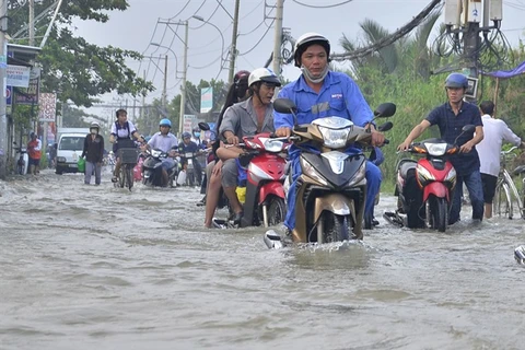
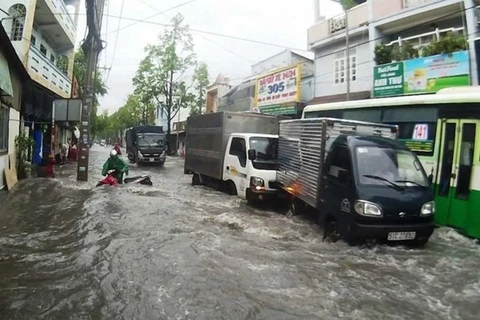
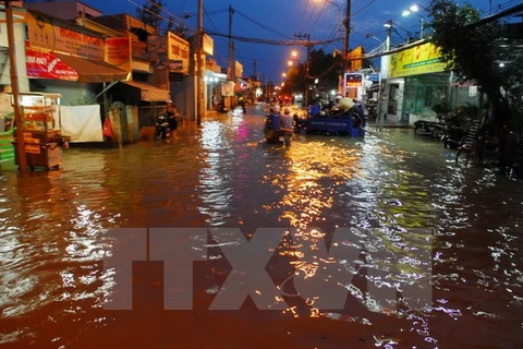
HCM City (VNA) - High tides have exceeded warning level three of six, submerging Ho Chi Minh City streets and causing terrible traffic congestion.
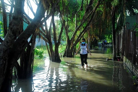
The tides have flooded several streets and alleys since December 6. The city’s central area, moreover, experienced rising tides for the first time.
Huynh Tan Phat street in district 7, Le Van Luong street in Nha Be district, Ho Ngoc Lam street in Binh Tan district and Vo Van Kiet avenue were among spots severely affected.
Business activities were suspended and homes and assets were damaged. Hundreds of vehicles stalled due to flood water, causing traffic jams.
District 2’s Thao Dien commune, a place of modern high-rise apartments and a hub of the city’s expatriate community, witnessed the same situation. Some of the many flooded streets included Quoc Huong street, street 41 and 65.
Responding to the rising tides, people set up simple anti-flood systems for their homes, using sandbags and Styrofoam boxes, which had little effect.
Ton Thi Bay of Nha Be district complained to Tuoi tre (Youth) newspaper about the rising tides’ consequences.
“Dealing with the tides is exhausting. I feel like I am living in the Mekong Delta, not in the city,” she said.
HCM City has invested nearly 2,500 billion VND (110 million USD) in flood prevention projects in 2017. However, the projects have brought little improvement as the city has faced severe flooding due to rising tides, water discharge and torrential rains recently.
At the sixth session of the HCM City People’s Council on December 4, experts suggested massive urban development and skyscraper construction contributed to the situation.
Deputy Nguyen Van Xuan of Binh Thanh district cited Nguyen Huu Canh street as an example.
With five residence complexes and more than 18,000 apartments, this area has become the most severely flooded spot of HCM City. Moreover, the huge population and traffic influx have made the street subside and destroyed its drainage system, leading to frequent waterlogging, according to a report issued by HCM City Department of Transport.
The Southern Hydro-Meteorological Station said that, under the effect of strong winds on the East Sea (South China Sea), the tide level on Sai Gon – Dong Nai river system had risen quickly in the last two days and reached its peak of 1.68m, 0.22m higher than the warning level three, on December 6 morning.
The water level is expected to decrease in the next days but remain high.
The Sai Gon River in the southern province of Binh Duong has reached a height of 1.62m, its highest point in 66 years, causing serious disruption to local life and challenging flood prevention strategies, local authorities said.
The water level rise was intensified by continuous rain for the last two days. It has now surpassed the level of alarm by 0.32m and is 0.03m higher than last year’s record.
It has destroyed parts of the Sai Gon River bank with cracks three metres long appearing on the bank, canals and sewage gates, causing water to overflow on about 110m of the bank, according to the Steering Committee for Disaster Prevention and Rescue in the province’s Thu Dau Mot City and the Centre for Rural Clean Water Exploitation and Irrigation Investment.
About 70ha of agricultural production land and 510m of roads were damaged causing inconvenience for 460 households in the affected area. Floods of between 0.1-0.6m occurred everywhere in the city.
Vu Ngoc Thin, deputy director of Binh Duong’s Irrigation Department, said the department had coordinated with the Disaster Prevention and Rescue Committee of Thuan An Town in Thu Dau Mot City and other local authorities to mobilise all materials and deploy forces to deal with the damage caused by the rising water level.
To prevent floods that will likely result from the tide increase, Thin said, the standing office of the provincial Steering Committee for Disaster Prevention and Rescue has requested its branch in Thu Dau Mot City to take all necessary measures to help locals stabilise their lives as quickly as possible.-VNA
VNA

