Localities gear up for super typhoon Mangkhut
Northern and north-central localities have taken measures to prepare themselves for super typhoon Mangkhut, which is forecast to bring heavy rains and whirlwind to the regions on September 17-18.
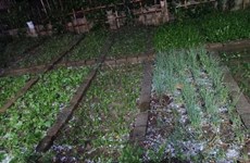
 Developments of typhoon Mangkhut (Photo: VNA)
Hanoi (VNA) – Northern and north-central localities have taken measures to prepare themselves for super typhoon Mangkhut, which is forecast to bring heavy rains and whirlwind to the regions on September 17-18.
Chairman of the People’s Committee of the northern port city of Hai Phong has asked the city’s Steering Committee on Natural Disaster Prevention and Control, Search and Rescue to inform all vessels not to operate at sea and cancel all waterway transport and entertainment activities at sea tourism sites.
Transport through Tan Vu-Lach Huyen bridge and some other river crossing bridges has been banned.
Localities across the city have been ready to evacuate locals in risky areas, especially in coastal and river mouth areas, while ensuring safety for dykes and works under construction.
On September 15 and 16, the city has formed inspection teams to examine preparations in localities.
In early September 16, Deputy Prime Minister Trinh Dinh Dung inspected preparations for Typhoon Mangkhut in the northern coastal province of Quang Ninh.
He visited the Ha Nam dyke system and Yen Lap lake in Quang Yen town, among others.
Lauding Quang Ninh’s efforts in responding to the storm, the Deputy PM noted that the storm has ravaged countries such as the Philippines and China, thus it is necessary to be careful prepared for it to avoid losses.
Particularly, Quang Ninh should take measures to prevent floods in mines and industrial parks, and ensure absolute safety tourists, he said.
By the noon on September 16, Quang Ninh had called all vessels ashore and reinforced dykes, while guiding locals on necessary measures to prepare for the storm.
Meanwhile in the northern coastal province of Nam Dinh, all vessels have been requested to return ashore and dock in safe shelters.
By the morning of September 16, more than 1,900 vessels with nearly 5,700 labourers had moved to safe shelters.
Localities, especially those along the coastline, had prepared plans to move locals in risky areas to safer places, while calling locals in aquatic farms and beaches to return home by September 16’s afternoon. Public buildings had also been reinforced.
According to the National Central for Hydrometeorology Forecasting, at 7am of September 16, the storm’s eye was at about 20.6 degrees north and 115.5 degrees east, on the northeast of the East Sea, about 320km east and southeast of China’s Macau. It sustained winds of up to 150km per hour.
It is forecasted is predicted to move west-northwest at a speed of 25-30km per hour, encroaching Guangxi province of China by dusk of September 16 before weakening to a low pressure.
Due to effects of the storm, in early September 17, some northern provinces of Quang Ninh, Cao Bang, Hai Phong, Bac Giang, Bac Kan and Ha Giang will see heavy rains and strong winds, with rain fall reaching about 100-150mm averagely, and high risks of floods and landslides.-VNA


You should also see

Agro-forestry-aquatic product exports post trade surplus of 4.74 billion USD in four months
Vietnam’s agro-forestry-aquatic product exports raked in some 19.06 billion USD in the first four months of 2024, up 23.7% year-on-year, the Ministry of Agriculture and Rural Development (MARD) reported.


See more
 Environment
Heavy showers, hail hit Lao Cai
Heavy showers accompanied by hail suddenly poured down in the northern mountainous province of Lao Cai at around 6:30pm on April 24.
 Environment
Drought at peak dry season impacts over 20,000ha of farmland
About 20,090ha of farmland and over 2,600 households have been hit by drought and water scarcity in the central region, Central Highlands, and southeastern region, which are now in the peak period of the 2023 - 2024 dry season.
 Environment
Hoa Phat steel products certified to meet greenhouse gas inventory standard
Vietnamese steel giant Hoa Phat Group has announced that BSI - the UK's leading international certification organisation - certified ISO 14064-1:2018 standard and ISO 14067:2018 on greenhouse gas inventory for steel products of its subsidiary - Hoa Phat Dung Quat Steel JSC.
 Environment
Vietnam supports global agreement on plastic pollution
A delegation of Vietnamese negotiators joined those from 176 countries worldwide at the fourth session of the Intergovernmental Negotiating Committee (INC-4) on plastic waste in Ottawa, Canada, on April 23.
 Environment
Consultation workshop on Cambodia’s Funan-Techo canal held in Can Tho
The Vietnam National Mekong Committee (VNMC) on April 23 held a consultation workshop on Cambodia’s proposed Funan-Techo canal project which has raised concerns about potential impacts on the Mekong river.