Mekong River resources must be shared among Vietnam, neighbours

Le Duc Trung, Chief of the Office of Vietnam National Mekong Committee, spoke to the newspaper Tin Tuc (News) about how to share the Mekong River to the benefit of all regional countries.
Mekong River resources must be shared among Vietnam, neighbours ảnh 1
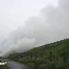
A view of the Mekong River basin (Source: VNA)

Hanoi (VNA) – Le Duc Trung, Chief of the Office of Vietnam National Mekong Committee, spoke to the newspaper Tin Tuc (News) about how to share the Mekong River to the benefit of all regional countries.

* Many experts have blamed the high intrusion of salty water into the Cuu Long (Mekong) Delta on climate change and the low level of water running from the upper reach to the lower reach of the Mekong River delta. How do you respond to their arguments?

Based on our hydrometereological data and the water level in the Mekong Delta in Southern Vietnam over the past 30 years, I can say that there are two main causes of drought in the Mekong Delta: water coming from the upper reach of the Mekong River (accounting for over 90 percent) and the rainfalls in the region, plus the use of water in the Delta coupled by impacts from the sea.

This year, the rainfall in the Mekong Delta has been extremely low – a record low in history. No rain was reported in February. As a result, it has seriously affected the water flow in the Mekong River, including the portion running through Vietnam.

The rainfall is low while the demand for water in all countries sharing the Mekong River is high, and Vietnam is situated at the lower end of the river. This has resulted in a serious drought in the Mekong Delta. According the our hydrometerreological data at the Tan Chau and Chau Doc stations on the Tien and Hau rivers, the water levels in these two stations were also at their lowest levels in their log books.

In Vietnam, late March and early April will be the peak of the dry season in Vietnam. So, the situation will become more serious in the next two months.

In addition, poor water regulation among projects in the Mekong basin has contributed to the problem of water scarcity in the lower basin. At present, on the main tributary of the Mekong River, there are already a few Chinese projects and other international projects built on the main tributary. Due to drought, they don’t discharge water down to the lower end of the river. In addition, Thailand has also built some projects causing the diversion of water in the region. All these activities have rendered the drought in the lower Mekong Delta more serious.

For our Mekong Delta, the low rainfall in January and February coupled with high tides has worsened the intrusion of salty water into the Delta.

* Does the Mekong River Commission have conducted any impact assessment of reservoirs on the upper reach of the Mekong River on the region’s socio-economic development?

Over the past three years, the Vietnamese Government has assigned the Vietnam National Mekong Committee to conduct studies on the impacts of hydropower plants on the main tributary of the Mekong River in the Mekong Delta Region and the Mekong Delta of Vietnam and Cambodia as a whole. The latest study was completed in December 2015 and sent to the Government.

According to the study, hydropower plants built on the main tributary of the Mekong River and some projects in China’s Yunnan Province have caused serious consequences for the river flow of the Mekong River, particularly in the dry season. It is the main cause of saltwater intrusion into the Mekong Delta region in Vietnam. In addition, it also has negative impacts on Vietnam’s aqua products and alluvium.

According to the latest report, the volume of aqua products from the Mekong Delta will drop by 50 percent while the alluvium will drop by 70 percent. This will seriously affect the local people’s livelihoods, the region and the country’s socio-economic development.

At present, there are three major hydropower plants on the upper reach of the Mekong River: one belonging to China (it is already in operation), and the other two – Don SaHong and Xayaburi - are from Laos and are in the process of being constructed.

* In the context of climate change, what should countries sharing the Mekong River do to balance the interests of each nation?

All nations have a right to pursue their socio-economic development goals. But during their exploitation of the Mekong River, they should respect international laws and practices, particularly the use of water resources - which was adopted by the UN General Assembly on May 21, 1997 and came into effect in 2014 - and the Co-operation Agreement on the Sustainable Development of the Mekong River in 1995.

As a member of the Mekong River Commission (MRC), Vietnam has regularly exchanged information with Cambodia and Thailand on the use of water on the Mekong River.

In the near future, the MRC will send a letter of request to China to ask it to consider issues related to tapping water from the Mekong River.-VNA

VNA

See more

High waves in Ly Son island, Quang Ngai province due to Typhoon Kalmaegi. (Photo: VNA)

Central, Central Highlands localities respond to Typhoon Kalmaegi

As Typhoon Kalmaegi, the 13th storm to hit the East Sea this year, intensifies and heads toward Vietnam’s central coast, localities across the central and Central Highlands regions, including Dak Lak, Lam Dong, Da Nang and Quang Ngai, have activated their highest-level disaster response measures to ensure the safety of people and property.

A map released at 2pm on November 4, tracking the path of Typhoon Kalmaegi (Source: National Centre for Hydro-Meteorological Forecasting)

PM urges proactive measures in response to Typhoon Kalmaegi

As Typhoon Kalmaegi is expected to enter the East Sea on the morning of November 5, with sustained winds of level 13–14 and gusts reaching level 17, Prime Minister Pham Minh Chinh has ordered ministries, sectors, and local authorities to implement the highest-level response measures to protect lives and minimise damage.

Residents in the buffer zone of the UNESCO-recognised Western Nghe An Biosphere Reserve (Photo: VNA)

Vietnam's World Biosphere Reserves eye to become ideal destinations

Vietnam's World Biosphere Reserves have truly become a rendezvous for integration, cooperation, and the exchange of information and experiences among countries and international organisations in the field of conservation and sustainable development, as well as an ideal destination for domestic and international tourists, heard a conference in the central province of Khanh Hoa on November 3.

Heavy rain and prolonged flooding have caused deep inundation, making transportation difficult. (Photo: VNA)

Heavy downpours, floods leave 37 dead, five missing

In addition, floods have submerged and damaged 7,897 hectares of paddy and crops, and 64,356 livestock and poultry have died or been swept away. Across the nation, 103 houses have collapsed or been washed away, 451 others damaged, and 12,676 flooded.

Heavy rain causes severe flooding on many roads across Nghe An province on November 3. (Photo: VNA)

Storm Kalmaegi intensifies, authorities warn of flooding and landslides

From early November 3 to late November 4, areas from Ha Tinh to Da Nang and eastern Quang Ngai are expected to experience very heavy rainfall — 200–300mm on average, and up to 600mm in some places. Areas in Ha Tinh province, the northern part of Quang Tri province, and the eastern part of Quang Ngai province may see 100–200mm of rain, with localised totals exceeding 350mm.

Farmers harvest rice in the Mekong Delta. (Photo: VNA)

Agricultural sector to cut at least 15% greenhouse gas emissions by 2035

The project on low-emission crop production for the period for 2025-2035, with a vision extending to 2050, focuses on high-emission crops such as rice, cassava, sugarcane, coffee, and bananas. It aims to pilot at least 15 farming models nationwide that are ready for carbon credits and meet international standards.

Soldiers transport rice to distribute to flood-hit residents on October 31. (Photo: VNA)

PM orders urgent support for flood-hit localities

To ensure residents' safety and prevent hunger and disease outbreaks, the PM asked the Minister of Finance to immediately allocate rice from national reserves to flood-hit communities, based on requests from provincial authorities, including Quang Ngai. Implementation results should be reported to the PM by October 31.

High tides hit many areas in Can Tho city. (Photo: VNA)

JICA provides over 9 billion VND to help Can Tho improve drainage system

Japan's Fukuoka city will share its experience and advanced technologies to help Can Tho tackle three major issues: flood damage and untreated wastewater discharge, inefficient management of wastewater treatment plants, and low public awareness about connecting private drains to public systems.

The rising water level on Ve river (Photo: VNA)

Central Vietnam hit by torrential rains till late October

The deluge stems from a combination of atmospheric factors, including a low-altitude cold air mass, a northward movement of the intertropical convergence zone and humid easterly winds at elevations between 1,500m and 5,000m, NCHMF Director Assoc. Prof Mai Van Khiem said, adding that this configuration is a classic driver of prolonged, high-intensity rainfall in the region.

A flooded area in the central region (Photo: VNA)

Record-breaking floods loom on Vu Gia–Thu Bon rivers

The meteorological agency has issued a warning of prolonged and widespread flooding in low-lying and riverside areas, with severe inundation expected in urban zones in Da Nang. There is also a high risk of flash floods and landslides in the mountainous areas of Da Nang city.

The 254 lane, Pham Chau Trinh street in Hue is heavily flooded dueto torrential rain (Photo: VNA)

Heavy rain and rising floods hit central region of Vietnam

From late October 26 to the early hours of October 27, areas stretching from Hue city to Quang Ngai province experienced heavy to extremely heavy rainfall, with some places recording over 100mm. The Bach Ma station in Hue measured 119.8mm, while the Rach Bun station in Dong Thap recorded 165.8mm.