More radar installed to improve accuracy in storm, rain forecasting

The Vietnam Meteorological and Hydrological Administration (VMHA) has built a project to enhance the National Centre for Hydrometeorological Forecasting (NCHMF)’s capacity to generate warnings on thunderstorms, lightning, storms, and rain by installing five new radar stations across the country.
More radar installed to improve accuracy in storm, rain forecasting ảnh 1
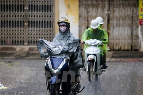
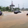
Vehicles move in the rain (Photo: VNA)
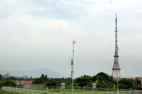
Hanoi (VNA) – The VietnamMeteorological and Hydrological Administration (VMHA) has built a project toenhance the National Centre forHydrometeorological Forecasting (NCHMF)’s capacity to generate warnings onthunderstorms, lightning, storms, and rain by installing five new radarstations across the country.

The stations will belocated on Pha Din mountain pass in the northern mountainous province of DienBien, in Viet Tri city of the northern midland province of Phu Tho, in NhaTrang city of the central coastal province of Khanh Hoa, in Pleiku city in the CentralHighlands province of Gia Lai, and in Quy Nhon city in the south centralprovince of Binh Dinh.

According to Bui Thi Hong Trang fromthe VMHA, the stations can supply high-resolution weather information withinhundreds of kilometers, which is necessary for the forecasting of coastalstorms, thunderstorms, and heavy rains.

The stations will be equipped withVaisala’s C-WRM200 dual polarisation Doppler weather radars, a new radargeneration with higher sensitivity and lower costs, said Trang.

She added that along with theimproved quality of statistics, the radars will also help improve accuracy inalerting dangerous weather phenomena.

Vietnam is one of the countries hardhit by climate change with frequent extreme weather conditions.
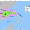
According to the NHMC, the year of2018 will see about 12-14 storms and tropical depressions in the East Sea, withsome 4-6 storms forecast to directly affect Vietnam’s mainland.
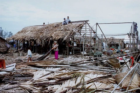
Recently, torrential rains and floodsattacked several northern mountainous provinces, especially Ha Giang and LaiChau where flash floods and landslides left 23 dead and 10 missing.

The floods also pulled down or swept away 161 houses,damaged 958 homes, and submerged 1,800 others.

In addition, more than 1,500 ha of rice and crops wereinundated or destroyed, while nearly 600ha of aquaculture were damaged, and 738cattle heads and over 13,800 poultry were killed.

Total damage was estimated at nearly 500 billion VND(around 21.8 million USD).-VNA
VNA

See more

A green sea turtle returns to lay eggs on Cau Cang Beach. (Photo: VNA)

Rare sea turtle lays eggs on Lam Dong province's Hon Cau Beach

In recent years, to raise public awareness of marine conservation and sea turtle protection, the Hon Cau Marine Protected Area has actively engaged local residents and volunteers in beach patrols and nest ground monitoring. Thanks to these efforts, thousands of baby turtles have been successfully hatched and released back into the sea.

Emission inspections for motorcycles and motorised vehicles will begin in Hanoi and Ho Chi Minh City on July 1, 2027. (Photo: VNA)

Emission standards for motorcycles to be issued in July

Under the draft, motorcycles produced before 2008 will be subject to the lowest level of inspection standards, level 1, while those manufactured from 2008 onwards will be assessed to a higher standard. Similar rules will also apply to motorised vehicles, with level 1 for those manufactured before 2016.

At the workshop (Photo: VNA)

Vietnam consults stakeholders on climate change scenarios

The 2025 scenarios build on Vietnam’s 2020 projections, incorporating the latest findings from the Intergovernmental Panel on Climate Change’s sixth assessment report and insights from domestic and global partners. The focus is on extreme weather events, particularly in urban areas, and rising sea levels, which threaten Vietnam’s low-lying coastal regions. The goal is to guide policymaking, urban planning, and local adaptation strategies.

Jonathan Wallace Baker, UNESCO Representative in Vietnam (right), presents the UNESCO Global Geopark Certificate for Lang Son to the provincial leadership. (Photo: VNA)

Lang Son becomes Vietnam’s 4th global geopark

Lang Son Global Geopark spans over 4,842 square kilometres, roughly 58% of the province, and is home to around 627,500 people. It features a rich blend of geological wonders and cultural heritage, including stunning caves and sinkholes such as Nguom Mooc Cave, Tham Lum and Ung Roac. Its biodiversity is also protected within the Huu Lien Nature Reserve.

Visitors flock to see rare insect specimens at the Da dang sac mau con trung Vietnam (The Diversity of Vietnamese Insects) exhibition at the Da Nang Museum. (Photo: nld.vn)

Da Nang exhibition features rare insects endemic to Vietnam

To run until July 13, the Da dang sac mau con trung Viet Nam (The Diversity of Vietnamese Insects) exhibition at the Da Nang Museum features hundreds of rare insect specimens, aiming to spotlight the diversity and uniqueness of the country’s endemic insects.

The Phu Ho agricultural cooperative in Phu Ho commune, Phu Vang district, Hue city mobilises manpower and pumps to drain floodwater and save rice crops for local farmers. (Photo: VNA)

PM orders strengthened disaster preparedness ahead of storm season

Under the directive, the PM instructed relevant agencies to regularly inspect, supervise and proactively implement disaster prevention, response and rescue measures in line with their assigned roles and mandates, ensuring readiness, avoiding passivity or delays, and maintaining operational continuity amid ongoing political and administrative restructuring at levels.

The research team collects seawater samples in Ha Long Bay and Cua Luc. (Photo: VNA)

Vietnam pioneers use of AI and remote sensing to monitor seawater quality

According to Dr. Vu Anh Tuan, Deputy Director General of the Vietnam Space Centre and head of the project, this is the first study in Vietnam to simultaneously employ Sentinel-2 satellite data, advanced machine learning algorithms, and the Google Earth Engine (GEE) cloud computing platform to model and monitor key seawater quality parameters.