Planning on Red River banks needs work
Hanoi has created urban development plans for the banks of the Hong (Red) River, yet problems remain due to lack of flood and dyke planning.
 The blueprint of residential area planning on Red River's banks (Photo ktdt.vn)
Hanoi (VNS/VNA) - Hanoi has created
urban development plans for the banks of the Hong (Red) River, yet problems remain due to
lack of flood and dyke planning.
Planners have been seeking solutions to balance sustainable development with land and water resources.
In 2006, the Ministry of Agriculture and Rural Development submitted a plan to the Government on flood prevention and control and dyke system reinforcement on the Red and Thai Binh rivers, reported Kinh Te Do Thi (Economy and City) newspaper.
Under the plan, it was necessary to move 855,993 people who lived on an area of 12,504ha on riverbanks to ensure safe flood discharging.
The areas for housing were below 15 percent of the river banks in Tam Xa- Xuan Canh and Long Bien-Cu Khoi areas in Hanoi.
The plan, which was approved but has not yet been carried out, was estimated to cost 113 trillion VND (4.9 billion USD). Along with funding from the State budget, revenue was to be drawn from the auction of land use rights in the river bank or investment in the public-private partnership (PPP) form.
This meant money collected from using the land would be used for flood drainage, so the area for flood drainage would be reduced to be used as housing, making flood drainage less safe.
The flood drainage corridor which was built by French irrigation engineers in 1905 has been degrading yearly.
For example, before merging with Hanoi, Ha Tay province allocated tens of thousands of hectares of land in the flood drainage corridor to real estate developers.
At present, many rivers in Hanoi and other provinces in the Red River Delta have been seriously polluted, which has caused a shortage of water for farming.
These issues have left Hanoians awaiting proper planning along the Red River to effectively use land and water for sustainable agriculture.
The section of the Red River flowing through Hanoi is more than 120km.
The riverbank is a large area so Hanoi could choose 1 or 2km alongside the river to carry out a trial planning project.
Recently, a group of Vietnamese and international urban planners proposed a plan for zoning a safe area which could ensure sustainable development for urban areas, farming and the environment.
The safe area would be protected by a concrete dyke system.
Residents currently living nearby the mudflats would be reallocated to at least 20m above sea level, freeing up the entire ground space and creating an extra 50-80ha for drainage in the flood season.
The river mudflats, which feature beautiful trees, would become a new park among hundreds of hectares of water surface of the river.
In the dry season, this place would be a safe and green park while in the flood season, it would be a training field for militia and youth volunteers to practice swimming and rescuing activities.
The plan is expected to create public assets worth billions of dollars, increase dynamism for the local economy and generate millions of new jobs for Hanoi and neighbouring provinces.
The same plan was carried out in some riverside cities of China like Wuhan, said the newspaper.
Additionally, the solution meets the essential requirements of flood prevention and dyke protection, adapting to extreme climate change at the highest level.
At present, wastewater does not flow into the city’s sewers but directly into the Red River, meaning Hanoi needs to plan for wastewater collection to eliminate pollution source in the river./.


You should also see

Agro-forestry-aquatic product exports post trade surplus of 4.74 billion USD in four months
Vietnam’s agro-forestry-aquatic product exports raked in some 19.06 billion USD in the first four months of 2024, up 23.7% year-on-year, the Ministry of Agriculture and Rural Development (MARD) reported.


See more
 Society
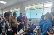
Traffic accidents leave 138 deaths in five-day holidays
The freshly ended five-day holidays saw 347 traffic accidents nationwide, causing 138 deaths and 285 injuries.
 Society
PM asks for effective preventive solutions against forest fires
Prime Minister Pham Minh Chinh has issued an official dispatch, requesting ministries, sectors, and localities to continue vigorously and effectively implementing fire prevention and control measures nationwide.
 Society
Overseas Vietnamese visit Truong Sa, DKI platform
Nearly 70 Vietnamese expatriates from 22 countries recently returned to their homeland and visited the Truong Sa (Spratly) and DKI platform, as part of a trip co-organised by the State Committee for Overseas Vietnamese Affairs and the High Command of the Vietnam People's Navy.
InfographicTargets in digital society development to 2025
Implementing the “National Digital Transformation Programme to 2025, with a vision to 2030”, Vietnam has to date attained remarkable achievements, with awareness about digital transformation constantly improving.
 Society
PM requests prompt actions to fix consequences of occupational accident in Dong Nai
Prime Minister Pham Minh Chinh on May 1 signed a dispatch demanding prompt actions to deal with the consequences of a serious workplace accident that happened in a wood factory in southern province of Dong Nai earlier the same day, as well as to support victims.