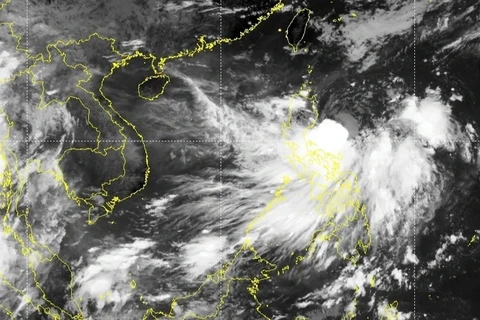
Hanoi (VNA) – Under the influence of Storm Ma-on, the third to enter the East Sea this year, the northern region and the north central province of Thanh Hoa will experience moderate to heavy rains and thunderstorms from the evening of August 25 to August 27.
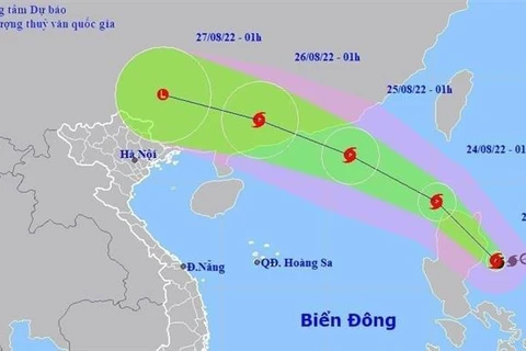
According to the National Centre for Hydro-Meteorological Forecasting, at 4 am on August 24, the storm eye was at around 19.1 degrees north and 118.5 degrees east, with the strongest velocity of 89-102km per hour.
In the next 24 hours, it is forecast to move west-northwest at about 20-25km per hour. At 4am on August 25, its centre will be at about 190km to the south-southwest of Hong Kong (China) while the strongest winds will be 103-117km per hour.
At 4am on August 26, Ma-on will go northwest, traveling 25km per hour and weaken into a tropical depression.
The storm will abate into a low-pressure area in the following 24 hours, the centre said./.
VNA


