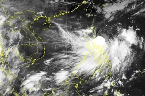
Hanoi (VNA) – Storm Ma-on is predicted to enter the East Sea and continue intensifying in the next 24 - 48 hours, according to the National Centre for Hydro-Meteorological Forecasting.
At 1am on August 23, the storm eye was at around 16.3 degrees north and 123 degrees east, with the strongest velocity of 75 - 88km per hour and gusts of 100 - 120km per hour.
In the next 24 hours, Ma-on will move northwesterly at about 15 - 20km per hour. At 1am on August 24, its centre will be on the northwest of the Philippines’ Luzon Island and sustain a velocity of 75 - 88km per hour with gusts of 115 - 135km per hour.
In the next 24 - 48 hours, it will go west-northwesterly at around 20km per hour, enter the East Sea, and continue to gain force. At 1am on August 25, its eye will be at about 240km to the southeast of Hong Kong (China) while the strongest winds will be 89 - 102km per hour and gusts 118 - 149km per hour.
It will continue moving in the same direction at the same speed in the following 48 - 72 hours. The eye will be on the mainland of China’s Guangdong province at 1am on August 26, when Ma-on will sustain winds of up to 62 - 74km per hour and gusts of 89 - 102km per hour.
The storm will abate into a low-pressure area in the next 72 - 96 hours, the forecasting centre said./.
VNA


