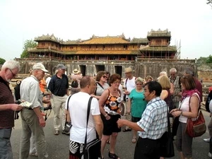
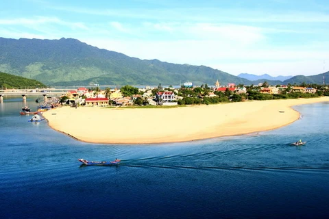
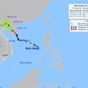
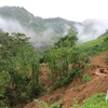
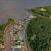
Panoramic view of Lang Co in Thua Thien - Hue province (Source: internet)
Under the national strategy on integrated coastal zone to 2020 with a vision to 2030, Thua Thien-Hue has built a plan on dividing the coastal zone into areas for different use to 2020, with a vision to 2030, with the aim of reducing and addressing contradictions in the exploitation, protection and improvement of the environment and natural resources in lagoon and coastal areas.
The plan also aims to preserve and optimize bio-diversity as well as cultural, historical and landscape values, while alleviating the impacts of natural disasters and climate change, and developing livelihoods for local communities, towards sustainable development.
Accordingly, 52 communes of five coastal districts and towns were divided into 11 areas in four main groups, which are the group of areas subject to preservation, protection and restoration, the group of buffer areas, the group of development areas and the group of reserve areas.
The group of preservation areas is projected to comprise four nature reserves, eight aquatic reserves and one area for ecological restoration. The area for ecological restoration is proposed to be the Ru Cha mangrove forest with an area of between 50-100ha, which will be turned into an ecological tourism site.
The group of development areas will comprise the Chan May economic complex, the tourism sites of Canh Duong-Lang Co-Chan May, Dong Duong-Ham Rong, Ho Truoi-Nhi Ho-Suoi Voi and the Cau Hai Lake-Tu Hien Estuary. Also included in this group are the sea ports Thuan An and Chan May, along with coastal fishing areas.
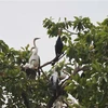
In the past, there was a vast area of mangrove forest in lagoons and along the coast, but at present only around 8ha of such forests remain in Huong Phong (Huong Tra town), Canh Duong, Lap An and Lang Co lagoons (Phu Loc district), and Tan My (Phu Vang district). The province plans to invest more in planting mangrove forests to improve protection against climate change impacts and the lagoons’ ecological systems.
Earlier, the World Wide Fund for Nature (WWF) and Microsoft funded a project on restoring mangrove forest in Thua Thien Hue. Over the course of two years, more than 23,000 mangrove trees were planted in Ru Cha forest, more than half of which were planted at aquaculture ponds. The trees help cleanse the water in ponds and improve living environment for fish and shrimp.
Vice Chairwoman of Huong Tra Town’s People’s Committee Nguyen Thi Thu Huong said the town has zoned off 300ha for mangrove forest development, including 70ha in Huong Phong commune. In the commune, local people play the main role in drafting plans for tree planting.
According to Huong, the development of mangrove forest will be combined with expanding tourism, particularly eco-tourism in connection with similar services in the Tam Giang lagoon region.
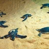
The most important achievement in coastal zone management is the establishment of 23 aquatic reserves with a total area of 600ha, with the involvement and contribution in the form of labour and cash of the local fishermen. The local fishing association has set up teams to patrol and deal with illegal fishing.
The community-based approach has proved to be efficient in protecting the aquatic resources while ensuring stable livelihood for local communities.
The provincial Department for Natural Resources and Environment has requested the Ministry of Natural Resources and Environment provide necessary equipment and vehicles to serve the survey, assessment, inspection and monitor sea, lagoon and island resources.
The province plans to carry out several projects on building a database and an integrated information system on marine resources, conducting surveys and zoning off wetland areas for protection and sustainable development./.
VNA