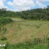
A landslide caused by flash flooding in the northern province of Tuyen Quang (Photo:baotuyenquang.com.vn)
Hanoi (VNA/VNS) - Vietnam is among the five countries most affected by high rates of natural calamity in the world. It has experienced great loss of human life and property damage, according to the Asian fund for the prevention and fight against natural calamity.
To address the problem, the Ministry of Natural Resources and Environment has directed related agencies to build a system of maps warning of natural calamity and to issue these maps to areas of provinces and cities that are commonly affected by floods, whirlwinds, landslides and dangerous cold snaps.
Based on these maps with a scale of 1/50,000, natural calamity preparedness offices of these districts have implemented works at relevant communes.
Along with this official map system, another map system has been implemented by local people, according to the website of the Centre for Preventing and Reducing Natural Calamity.
“Locals draw on local maps dangerous areas that could be affected by flash floods or ways to escape a severe storm,” said the centre’s director Nguyen Huu Phuc.
Prominent among the affected provinces is the northern province of Nam Dinh, based on maps drawn by the community to deal with natural calamities.
Nguyen Cong Chuc, head of a project funded by the USAID, said building maps at the community level was very important to define long-term plans to prevent and fight against natural calamities in the locality.
"The map localises concrete areas and evaluates locations that could be affected by floods and storms or provide a safe shelter for people. The most interesting thing about the maps are they are created by locals so they are very concrete and understandable because they have had experience of the spot," said Chuc.
Pham Thi Sang in Nam Dinh’s Truc Dinh Commune said she and her neighbours were trained to know the harm caused by floods so they were excited to join in drawing a map because they know very well the roads to safe places to escape storms and floods. "We place importance in this because it directly affects our lives."
She said she was thankful for being trained as many locals have changed their habits by serving rice and money as ways to take care of the elderly and disabled during flood season.
Sang’s neighbour Le Van Tuoi, 68, is a good consultant to agencies in charge of drawing a map in the most correct way.
Currently, USAID has supported Nam Dinh’s 24 communes to build the maps while setting up community-based groups to deal with natural calamities. The project has also supplied rescue equipment for times of calamity and guides local people to strengthen their houses for safety and to think ahead of how to deal with natural calamities that could occur.
Do Ngoc Huynh, Chairman of Giao Hai Commune in Hai Hau District, said his commune strictly carried out training on how to prevent and fight against calamity.
Local authorities in charge have been preparing "four works on the spot" training, such as being able to ready forces, rescue materials, equipment and logistics on the spot quickly.
As a result, the coastal commune of Giao Hai faced very few losses caused by Mirinae, the first storm of 2016, compared with other communes because of the careful preparations they had made beforehand.
Nguyen Quoc Thanh of the Geology Institute, who is in charge of creating the maps warning of potential natural calamities, said the maps helped inhabitants and local authorities know about and prevent losses caused by natural calamities.
According to this map, the northwestern province of Lao Cai has 534 areas threatened by landslides. Much more important is that there has already been a small landslide on the side of a mountain top in Nam Bat Hamlet of Tan Tien, but the map shows that the cracked mountain is expected to bring a much greater disaster.
The institute has built maps of especially dangerous areas in the provinces of Yen Bai, Lao Cai, Lai Chau, Lao Cai and Dien Bien.
It is expected that the detailed maps will be finished by 2020, he said.
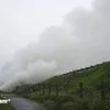
The northwestern province of Sơn La is often faced with severe flash floods and landslides that have badly affected its economic development and caused great losses to locals’ property and lives.
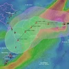
To deal with the problem, the province has applied GIS (a combination of IT and map technology) to build a map system that warns of flash floods and landslides over the entire province, and authorities can use these maps to build a long-term strategy for natural calamity preparedness, said Thanh.
Meanwhile, departments of natural calamity prevention in the central and southern regions have delivered maps and trained locals on how to deal with floods due to sea level rises in the provinces of Ninh Thuan, Khanh Hoa, Binh Thuan, Phu Yen, Dong Thap and Tien Giang.
The Minister of Natural Resources and Environment Tran Hong Ha says, "The maps have helped to define dangerous areas and areas that are being threatened with landslides that could affect inhabitants, transport and local economic development. The data in the maps are very important to serve works on the prevention, and reduction of losses caused by landslides during floods and storms in Vietnam’s mountainous areas.-VNA