Hanoi (VNA) – The Mekong Delta region, home to about 18 million people, is Vietnam’s largest agriculture hub. However, the region faces serious erosion in river and sea banks due to climate change and human factors.
According to the Vietnam Institute of Meteorology, Hydrology and Climate Change, 38 percent of the Mekong Delta’s land surface may be submerged by seawater in 2100, mostly because of human impacts.
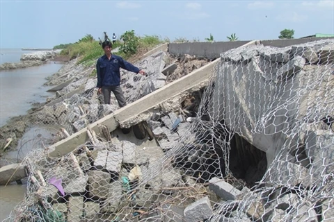
Currently, the region has 406 eroded dyke sections with a total length of 891km. Some dangerous areas include 70m of Vam Nao river’s bank in Cho Moi district, An Giang province where 18 houses fell into the river and another 91 were damaged. Another case is the 600m of the Tien River bank in Binh Thanh commune, Thanh Binh district of Dong Thap where 108 households were forced to evacuate and another 119 were partly affected.
An Giang has been one of the localities hit hardest by erosion. Major erosion incidents in 2010, 2012 and 2014 across the province caused serious damage to the locality’s infrastructure when hundreds of metres of roads collapsed into rivers.
The provincial Department of Natural Resources and Environment reported that the province has 51 erosion prone areas with a total length of about 162,550m, threatening 20,000 households.
The province saw 15 cases of river bank erosion in the first five months of 2017 with a total length of 1,224m, affecting 170 houses including 18 which completely collapsed.
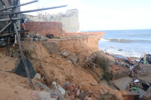
Meanwhile, in Bac Lieu province, more than 800m of sea dykes were broken in Dong Hai district. In Ca Mau, roads along O Ro canal in Ngoc Hien were destroyed, threatening the Dat Mui border post and local households.
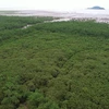
Erosion has also reduced forest areas in the Mekong Delta by 10 percent or 28,387 hectares.
A survey by the Vietnam Institute of Meteorology, Hydrology and Climate Change and the Vietnam Institute of Geosciences and Mineral Resources under the Ministry of Natural Resources and Environment showed that hydropower plant dams in the upstream Mekong River are one of the main causes of erosion in the Mekong Delta, as they keep mud and sand, leading to a lack of mud and sand downstream.
To Van Truong, an independent expert on water resources, said high risks of erosion in the Mekong Delta region can be seen through obvious changes in hydrology in the region as well as human impacts.
At the same time, aquaculture farming in coastal localities without planning has seriously affected mangrove forests, causing ecological imbalance and erosion in many regions, while illegal construction that encroaches rivers and hinder flood flow is another factor.
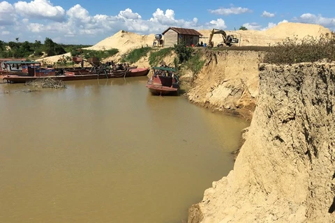
Sand exploitation in rivers is one of the most serious reasons behind the change of the flow, stressed Truong.
In mid-May, Deputy Prime Minister Trinh Dinh Dung and Minister of Natural Resources and Environment Tran Hong Ha led a Government working group on a tour to inspect erosion in a number of Mekong Delta localities.
Deputy PM Dung said that solutions have been applied in a temporary and passive manner due to a lack of reliable scientific research on the issue. He called on ministries to propose systematic measures to respond to landslides.
He urged ministries and sectors to focus on erosion alerts and forecasts, while helping evacuated people stabilise their lives.
Chairman of the An Giang People’s Committee Vuong Binh Thanh asked for 820 billion VND to move households from erosion affected areas and build settlements for them.
Measures to adjust river flow are crucial, along with strict management over sand exploitation in rivers, he said.-VNA
VNA

