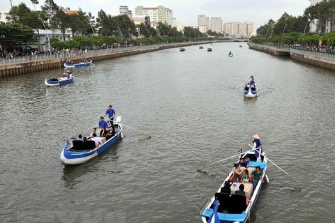
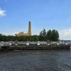
HCM City's new drainage water plan will take into account the city’s expansion and the impact of climate change, erosion and rising sea levels. (Photo: VNA)
 HCM City (VNS/VNA) - A plan for a new water-drainage network in Ho Chi Minh City has been submitted to the Prime Minister for approval.
The city has been using a water drainage plan approved in 2001 that covers the central area of about 650sq.km, which represents about 30 percent of the city's total area. The plan does not account for the impact of climate change, rising water levels and erosion.
Without a comprehensive overhaul of the drainage network over the next 10 years, the city would have to spend trillions of dong, so a new plan is essential, according to the ministry.
The new plan covers three times the area of the old plan, or about 2,100sq.km. It also includes studies of nearby provinces such as Dong Nai and Binh Duong.
Dang Phu Thanh, deputy chairman of the city’s Department of Construction, said that if the plan is approved, the city would refine the plan over the next nine months. Factors such as surface water, land and existing wastewater treatment plans will be considered.
The department is working with consultancy experts from Denmark and Japan on the drainage plan. Funding for the plan will come from the World Bank loans.
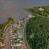
Dr Vu Ngoc Long, chairman of the Vietnam Institute of Ecology’s scientific council, noted that Ho Chi Minh City is surrounded by Sai Gon, Dong Nai and Vam Co rivers and has thousands of canals, ponds and lakes of various sizes.
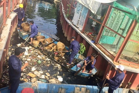
Millions of square metres of lakes, ponds and canals have been buried to create land for development. For the water drainage plan to work effectively, the city needs to dredge existing canals to improve water flow and reopen as many buried canals as possible.
Architect Le Thanh Khai from the HCM City University of Architecture said the city should avoid filling future canals and have more detention basins between residential areas to reduce flooding.
The newly established Thu Duc city area is expected to have 10 percent of its land as parks, and 30 percent of them will have detention basins, according to the city's Department of Construction.
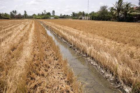
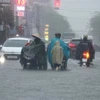
Because of heavy rains, land subsidence and high tides on the Sai Gon and Dong Nai rivers, HCM City suffers from heavy floods every year.
According to the Ministry of Natural Resources and Environment, the city’s rivers could rise by about 30cm by 2050 and 75cm by the end of the 21st century./.
VNA