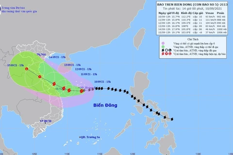
Hanoi (VNA) - Storm Lionrock, the seventh hitting the East Sea so far this year, has weakened into a tropical depression, while another storm, Kompasu, is becoming stronger and forecast to enter the sea soon, according to the National Centre for Hydro-meteorological Forecasting.
At 10 am on October 10, the depression was centered on the waters south of the northern province of Quang Ninh, around 100km off Hai Phong city, 150 km off Nam Dinh province and 260km off north-central Thanh Hoa province.
It packed winds of 40 to 60km per hour and squalls of up to 88km per hour, with a wind radius of 100km.
Over the next 12 hours, it will travel west-southwestward at 15 to 20km per hour and land in the region between Hai Phong and Thanh Hoa, with winds easing to 40-50km per hour.
In the next 12 to 24 hours, the depression will move in the same direction towards Laos and further weaken into a low-pressure system.
The storm eyewall, in combination with a strengthened cold front, will cause extremely rough seas in the Gulf of Tonkin, including the waters of Bach Long Vi Island, along with winds of up to 61km per hour and waves reaching two to four meters in height.
Under its impact, the coastal area from northern Quang Ninh to north-central Nghe An saw strong winds of 49 km per hour and squalls of up to 74km per hour on October morning, while torrential rains of 50 to 100 millimeters slashed the northeastern region, while less severe rains, of 50 to 150 millimeters, will dampen the northwestern part.
Over the next three days from October 10, heavy rains of up to over 150 millimeters will cover the north-central region from Nghe An to Quang Binh.
Flash floods and landslides may occur in mountainous areas while inundation is likely to hit low-lying areas, especially in mountainous areas in the northern and north central regions. Flooding may occur in northern rivers and streams as well as localities from Thanh Hoa to Ha Tinh.
Meanwhile, the National Centre for Hydro-meteorological Forecasting reported that Storm Kompasu has been active in the eastern waters of Luzon Island of the Philippines from October 10 morning.
At 10:am October 10, the storm was seen to move northwest at 25km per hour, packing winds of 75 to 90km per hours and squalls of up to 117km per hour.
From October 11, the storm is forecast to travel west at 15km per hours, continue getting stronger and enter the East Sea, according to the centre.
The National Steering Committee for Natural Disaster Prevention and Control has asked localities to ban vessels from going offshore depending on their situation, while inspecting areas with high risk of flash floods and landslides, designing plans to protect dyke and reservoir systems, and preparing vehicles and forces for rescuing activities./.
VNA


